
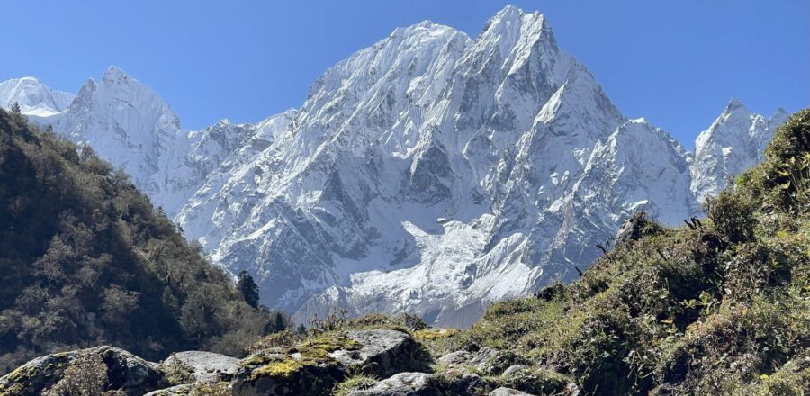
Manaslu Tsum Valley Trek – 22 Days Through the Hidden Himalayan Valleys of Nepal

Manaslu Tsum Valley Trek – 22 Days Through the Hidden Himalayan Valleys of Nepal

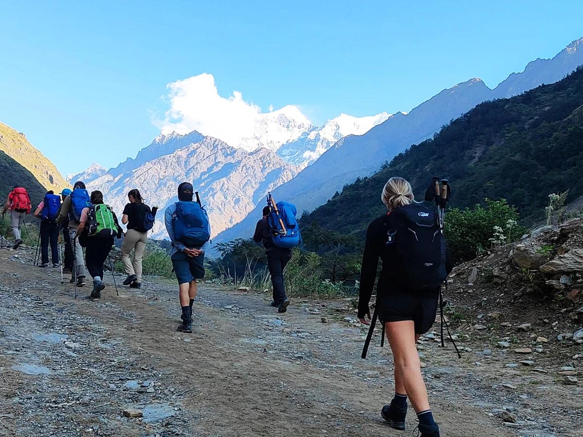
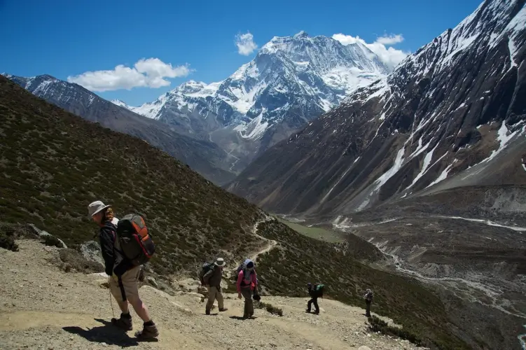
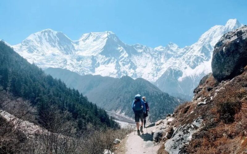
The Manaslu Tsum Valley Trek is a journey for travellers who want to experience a quieter and more remote side of the Nepal Himalayas.

Far from the busy trails of the Everest and Annapurna regions, this trek leads through the dramatic landscapes surrounding Mount Manaslu, traditional Gurung villages, ancient Buddhist monasteries, narrow mountain gorges and the culturally rich Tsum Valley.

What makes this journey particularly special is the contrast between its different sections. The trail begins with the rushing Budi Gandaki River and green hills before gradually moving into higher, colder and more rugged terrain. In the Tsum Valley, the atmosphere changes again, with Tibetan Buddhist traditions, centuries-old monasteries and isolated settlements surrounded by high Himalayan peaks.

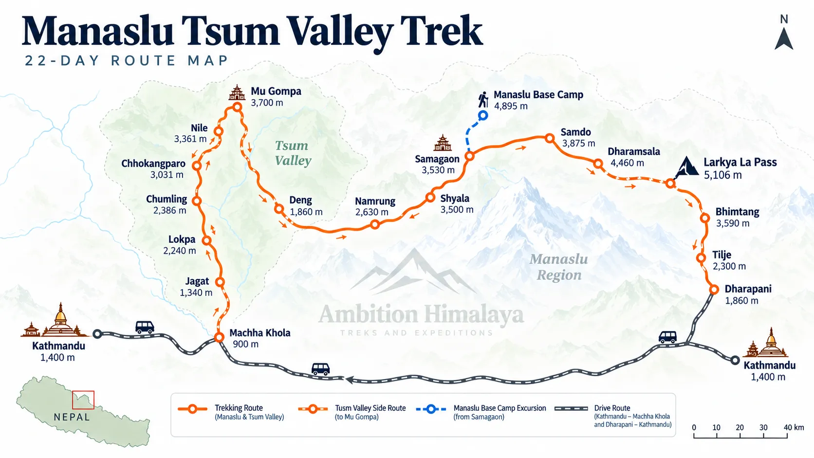
The journey eventually continues towards Samagaon and Manaslu Base Camp before reaching its highest point at Larkya La Pass at 5,160 metres. From there, the trail descends through Bhimtang, Tilje and Dharapani before returning towards Kathmandu.

This 22-day Manaslu Tsum Valley Trek is not simply about reaching one destination. It is a long Himalayan journey through changing landscapes, cultures and elevations, with every section offering something different.
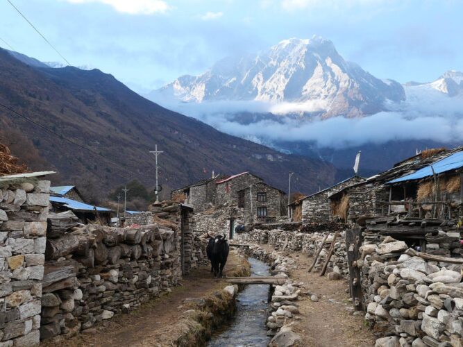
Manaslu Tsum Valley Trek Highlights

Manaslu Tsum Valley Trek Highlights

  • Explore the remote and culturally rich Tsum Valley
  • Trek through traditional Gurung and Tibetan-influenced villages
  • Experience the dramatic Budi Gandaki Valley
  • Visit Milarepa Piren Phu Cave
  • Explore Mu Gompa and Dhephu Gompa
  • Visit Rachen Gompa
  • Experience the mountain villages of Chumling, Chhokangparo and Nile
  • Explore Samagaon and the upper Manaslu region
  • Trek to Manaslu Base Camp
  • Visit Birendra Lake
  • Cross the challenging Larkya La Pass
  • Reach the highest point of the trek at 5,160 metres
  • Enjoy views of Manaslu, Himalchuli, Ganesh Himal, Himlung, Annapurna II and surrounding peaks
  • Walk through rhododendron and pine forests
  • Experience remote Himalayan communities away from the busier trekking routes
  • Private group discounts available

Manaslu Tsum Valley Trek at a Glance

Trek Details Information
Duration 22 Days
Region Manaslu & Tsum Valley
Maximum Altitude 5,160 m / 16,929 ft
Highest Point Larkya La Pass
Trek Starting Point Machha Khola
Trek Ending Point Dharapani
Major Highlight Manaslu Base Camp
Tsum Valley Highlight Mu Gompa & Milarepa Cave
Difficulty Challenging
Accommodation Hotels & Mountain Guest Houses
Trekking Style Guided Trek
Group Type Private / Group
Best Seasons Spring & Autumn

Why Choose the Manaslu Tsum Valley TrekWhy Choose the Manaslu Tsum Valley Trek?
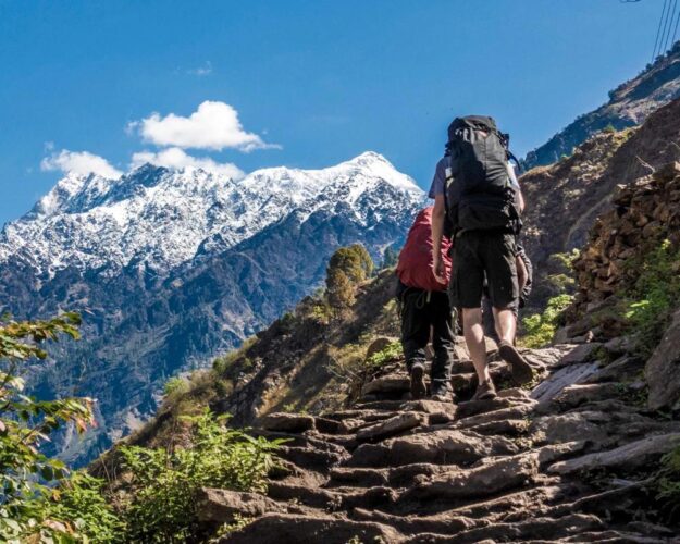
The Manaslu Tsum Valley Trek is ideal for trekkers looking beyond Nepal’s popular routes and wanting a deeper Himalayan experience. This 22-day adventure combines remote mountain scenery, authentic Tibetan Buddhist culture, traditional villages, ancient monasteries, and the challenging Larkya La Pass.

  • Remote & Less Crowded: Experience peaceful trails far from Nepal’s busiest trekking routes.
  • Two Treks in One: Explore the mystical Tsum Valley before continuing through the spectacular Manaslu Circuit.
  • Rich Tibetan Culture: Discover centuries-old monasteries, prayer walls, chortens and traditional Himalayan communities.
  • Exceptional Mountain Views: Enjoy dramatic views of Manaslu, Ganesh Himal, Himalchuli and other Himalayan peaks.
  • Mu Gompa Experience: Visit the remote and culturally significant Mu Gompa in the upper Tsum Valley.
  • Larkya La Adventure: Cross the famous 5,106-meter Larkya La Pass surrounded by impressive high-altitude scenery.
  • Authentic Himalayan Villages: Stay in local teahouses and experience the traditional lifestyle of mountain communities.
  • Varied Landscapes: Trek through lush forests, river valleys, alpine terrain, glacial landscapes and high mountain passes.
  • Perfect for Adventure Seekers: A rewarding combination of cultural discovery, wilderness, high-altitude trekking and Himalayan exploration.
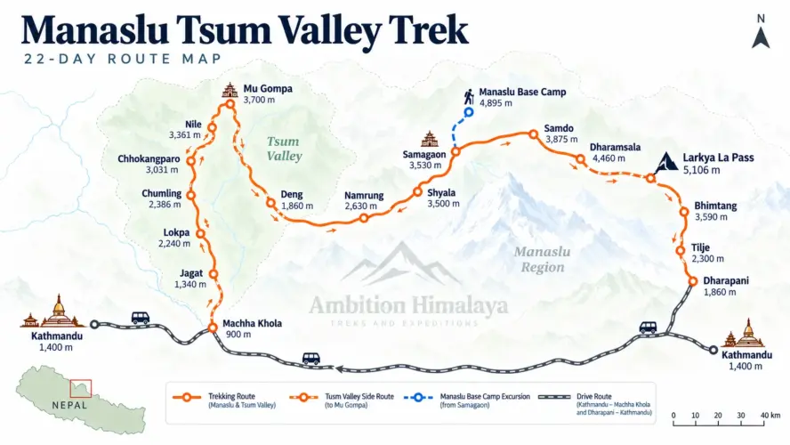
Manaslu Tsum Valley Trek Route

22-Day Manaslu Tsum Valley Trek Itinerary

Day 1: Arrival in Kathmandu

Altitude: 1,350 m
Accommodation: Hotel
Meal: Dinner

Your Manaslu Tsum Valley Trek begins in Kathmandu.

After arriving at Tribhuvan International Airport, our representative will meet you at the terminal and transfer you to your hotel.

Once you have settled in, you can rest after your journey or take a short walk around the neighbourhood.

The evening is kept relaxed, with time to meet the trekking team and prepare mentally for the adventure ahead.

A welcome dinner gives you an opportunity to experience traditional Nepali food before the trek begins.

Day 2: Free Day and Trek Preparation in Kathmandu

Altitude: 1,350 m
Accommodation: Hotel
Meals: Breakfast & Lunch

Before heading into the mountains, you have a preparation day in Kathmandu.

This is the time to check your trekking equipment, organise your backpack and make sure you have the essentials required for the journey.

Important trekking equipment includes good trekking boots, trekking poles, layered clothing, warm gloves, a warm sleeping bag, sunglasses, sunscreen, a sun hat, water purification supplies and personal medication.

You can also use part of the day to explore Kathmandu before the long trek begins.

A little preparation today can make a big difference once you are several days into the mountains.

Day 3: Drive from Kathmandu to Machha Khola

Distance: Approximately 160 km
Accommodation: Guest House
Meals: Breakfast, Lunch & Dinner

Today you leave Kathmandu by road and travel towards Machha Khola, the starting point of the trekking section.

The journey takes you away from the busy capital and into the countryside.

The route initially follows the Prithvi Highway before turning towards the northern valleys. Along the way, you pass through areas including Dhading Besi and Aarughat before continuing towards Machha Khola.

The scenery gradually changes from urban surroundings to terraced farmland, forested hills and river valleys.

Machha Khola is the final major settlement before the trek begins in earnest.

Overnight at a local guest house.

Day 4: Machha Khola to Jagat

Distance: Approximately 21 km
Walking: 6–7 hours
Accommodation: Guest House
Meals: Breakfast, Lunch & Dinner

Today marks your first full trekking day.

The trail follows the Budi Gandaki River through a landscape of green hills, rocky paths and traditional villages.

You pass Khorlabesi and continue towards Tatopani, where natural hot springs provide an interesting stop along the route.

The trail then continues towards Dobhan and Yaru Bagar, involving several ascents, descents and suspension bridge crossings.

Eventually, you reach Jagat, a traditional Gurung settlement at around 1,340 metres.

Jagat is an important point on the Manaslu trekking route and provides your first real feeling of being inside the Himalayan trail network.

Day 5: Jagat to Lokpa

Distance: Approximately 18 km
Walking: 6–7 hours
Altitude: 2,240 m
Accommodation: Guest House
Meals: Breakfast, Lunch & Dinner

The trail begins climbing more noticeably today.

Leaving Jagat, you follow the Budi Gandaki upstream through farmland and small settlements before reaching Ekle Bhatti.

From there, the landscape becomes increasingly rugged.

The route passes through a narrow gorge before reaching Philim. After Philim, the trail enters forested terrain dominated by rhododendron and pine.

This section feels considerably more isolated than the earlier part of the trek.

After several hours of walking through forest and mountain terrain, you arrive at Lokpa.

Day 6: Lokpa to Chumling

Distance: Approximately 8 km
Walking: About 4 hours
Altitude: 2,386 m
Accommodation: Guest House
Meals: Breakfast, Lunch & Dinner

Today is a shorter trekking day, giving you time to enjoy the changing landscape.

The trail descends towards the Lungwa River before continuing through lush pine and rhododendron forests.

After crossing a suspension bridge, the route climbs towards Gumling.

From here, you can enjoy views towards Ganesh Himal and Baudha Himal.

The trail continues through a series of climbs and descents before crossing the Syar Khola and reaching Chumling, also known as Lower Chum.

The village provides your first deeper introduction to the unique culture of the Tsum Valley.

Day 7: Chumling to Chhokangparo

Distance: Approximately 10 km
Walking: 5–6 hours
Altitude: 3,010 m
Accommodation: Guest House
Meals: Breakfast, Lunch & Dinner

The trail continues deeper into the Tsum Valley.

Following the Syar Khola, you walk through pine woodland towards Domje, one of the larger settlements in the lower Tsum Valley.

The route then continues towards Gho, where you can visit a local gompa before continuing uphill.

The final part of the day involves a gradual ascent to Chhokangparo, also known as Upper Chum.

As you gain altitude, the mountain scenery becomes increasingly impressive, with views towards Himalchuli and Ganesh Himal.

Day 8: Chhokangparo to Nile via Milarepa Piren Phu Cave

Distance: Approximately 10 km
Walking: 4–5 hours
Altitude: Around 3,500 m
Accommodation: Guest House
Meals: Breakfast, Lunch & Dinner

One of the cultural highlights of the Manaslu Tsum Valley Trek awaits today.

The trail leads towards Lamagaon and then to the famous Milarepa Piren Phu Cave.

According to local Buddhist tradition, the cave is associated with the great Tibetan Buddhist master Milarepa, who is believed to have meditated here.

The cave and surrounding religious sites provide a fascinating glimpse into the spiritual history of the valley.

After exploring the area, you continue through Phurbe, Pang and Chhule before crossing the Syar Khola and reaching Nile.

The landscape is increasingly high-altitude now, with traditional villages surrounded by barren Himalayan slopes.

Day 9: Nile to Mu Gompa and Hike to Dhephu Gompa

Mu Gompa: Approximately 3,700 m
Dhephu Gompa: Approximately 4,060 m
Walking: 2.5–3 hours to Mu Gompa + day hike
Accommodation: Guest House
Meals: Breakfast, Lunch & Dinner

Today’s journey is shorter in distance but rich in cultural and spiritual experiences.

From Nile, the trail follows the Syar Khola towards Mu Gompa.

The gradual climb passes chortens and traditional Buddhist features before reaching the remote monastery settlement.

After checking into the accommodation, you continue with a day hike towards Dhephu Gompa.

Situated at a higher elevation, Dhephu Gompa offers a quiet mountain setting and an opportunity to experience the spiritual atmosphere of this remote part of the Himalayas.

After the hike, return to Mu Gompa for the night.

Day 10: Nile to Chumling

Distance: Approximately 18 km
Walking: 6–7 hours
Altitude: 2,386 m
Accommodation: Guest House
Meals: Breakfast, Lunch & Dinner

The route now begins its return through the Tsum Valley.

You descend alongside the Syar Khola towards Chhule before continuing towards Rachen Gompa.

Rachen Gompa is an important Buddhist nunnery in the valley and offers another opportunity to experience the religious heritage of the region.

After visiting the area, the trail continues towards Pang and Phurbe before reaching Lamagaon.

From Lamagaon, you continue downhill towards Chumling.

The lower elevation becomes noticeable as the air grows warmer and the vegetation becomes thicker.

Day 11: Chumling to Deng

Distance: Approximately 19 km
Walking: About 7 hours
Altitude: 1,860 m
Accommodation: Guest House
Meals: Breakfast, Lunch & Dinner

Leaving Chumling, the trail descends through forested terrain towards Lokpa.

After reaching Lokpa, the route continues along the Syar Khola.

The landscape is filled with forest, river valleys and dramatic mountain slopes, with views towards Sringi Himal.

You cross Ghatta Khola before beginning the final section towards Deng.

Deng sits at a considerably lower elevation than the villages you have recently visited, making the change in climate noticeable.

Day 12: Deng to Namrung

Distance: Approximately 19 km
Walking: 7+ hours
Altitude: 2,630 m
Accommodation: Guest House
Meals: Breakfast, Lunch & Dinner

The trail climbs again today.

After crossing the Budi Gandaki River, you continue towards Rana and Bihi.

Waterfalls, forests and mountain scenery accompany much of the route.

The trail then reaches Ghap, where chortens and mani walls begin to appear more frequently.

From Ghap, it takes roughly another hour and a half to reach Namrung.

Namrung marks another important transition point as the landscape begins to take on a more alpine character.

Day 13: Namrung to Shyala

Distance: Approximately 10 km
Walking: About 6 hours
Accommodation: Guest House
Meals: Breakfast, Lunch & Dinner

After yesterday’s long walking day, today’s route is shorter but involves a significant climb.

The trail leaves Namrung and gradually ascends through oak forest towards Sho.

Continuing higher, you reach Lho, a culturally important village known for Ribung Monastery.

The monastery provides both cultural interest and beautiful views towards the Manaslu range.

From Lho, the trail continues across wider mountain paths before reaching Shyala.

The views become increasingly dramatic as the surrounding peaks begin to dominate the skyline.

Day 14: Shyala to Samagaon via Pungyen Gompa

Distance: Approximately 17 km
Walking: 4–5 hours
Maximum Altitude: Approximately 4,050 m
Accommodation: Guest House
Meals: Breakfast, Lunch & Dinner

Today brings you into the high Manaslu landscape.

Leaving Shyala, you walk through open grassland and thin woodland before reaching the junction towards Pungyen Gompa.

The trail leads towards yak pastureland where you can enjoy wide views across the surrounding mountains.

Pungyen Gompa sits in an impressive setting and is an important cultural stop on the route.

After exploring the area, the trail descends before continuing towards Samagaon.

At around 3,530 metres, Samagaon is one of the most important settlements in the upper Manaslu region.

Day 15: Samagaon to Manaslu Base Camp and Return

Manaslu Base Camp: Approximately 4,800 m
Distance: Approximately 12 km round trip
Walking: Around 7 hours
Accommodation: Guest House
Meals: Breakfast, Lunch & Dinner

Today is one of the major highlights of the entire trek.

From Samagaon, you begin the climb towards Manaslu Base Camp.

The trail initially climbs gradually towards Birendra Lake before becoming more rugged.

As you move higher, the terrain changes to rocky paths, small streams and increasingly barren mountain surroundings.

After several hours of climbing, you reach Manaslu Base Camp.

The enormous Manaslu massif rises above the valley, creating an unforgettable Himalayan panorama.

After spending time at Base Camp, you retrace your steps and return to Samagaon for the night.

Day 16: Samagaon to Samdo

Distance: Approximately 9 km
Walking: About 4 hours
Altitude: Approximately 3,860 m
Accommodation: Guest House
Meals: Breakfast, Lunch & Dinner

The trail continues towards the remote village of Samdo.

From Samagaon, you climb towards Birendra Lake before continuing through meadows and glacial streams.

Chortens and mani walls appear along the trail as you move deeper into the upper Manaslu landscape.

Samdo is a small settlement located close to the Tibetan border and strongly influenced by Tibetan Buddhist culture.

The short walking day gives you time to appreciate the stark beauty of this high-altitude environment.

Day 17: Samdo to Dharamsala

Distance: Approximately 12 km
Walking: About 5 hours
Altitude: Approximately 4,460 m
Accommodation: Guest House
Meals: Breakfast, Lunch & Dinner

The trail becomes more rugged as you approach the Larkya La section.

Leaving Samdo, you cross the Budi Gandaki River before following a gradual ascent towards Larke Bazaar.

This seasonal settlement provides views towards the Shyacha Glacier and the surrounding high mountain valley.

Beyond Larke Bazaar, the vegetation becomes increasingly sparse.

The trail crosses rocky terrain, chortens and mani walls before the final climb towards Dharamsala, also known as Larke Phedi.

With the Larkya La Pass crossing coming tomorrow, an early night’s rest is important.

Day 18: Dharamsala to Bhimtang via Larkya La Pass

Distance: Approximately 24.7 km
Walking: 7–8 hours
Larkya La Pass: 5,160 m
Accommodation: Guest House
Meals: Breakfast, Lunch & Dinner

This is the most demanding and memorable day of the Manaslu Tsum Valley Trek.

The trail begins with an early ascent across rocky terrain.

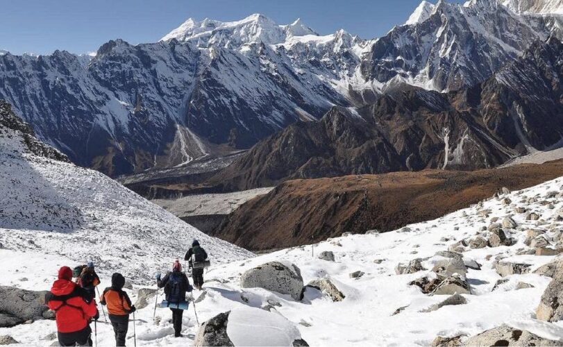
As you climb higher, the landscape becomes increasingly barren and alpine. The route continues along ridges marked by cairns before eventually reaching the summit of Larkya La Pass at approximately 5,160 metres.

This is the highest point of the trek.

From the pass, the surrounding panorama opens dramatically. Depending on weather and visibility, you can see peaks including Cheo Himal, Himlung, Kang Guru and Annapurna II.

After taking time to appreciate the achievement, the trail begins its long descent towards Bhimtang.

The descent can be steep and challenging, particularly after the long climb to the pass. The landscape gradually changes from rocky terrain to grassy areas and eventually rhododendron forest.

By the time you reach Bhimtang, one of the toughest sections of the journey is behind you.

Day 19: Bhimtang to Tilje

Distance: Approximately 20 km
Walking: Around 7 hours
Accommodation: Guest House
Meals: Breakfast, Lunch & Dinner

The landscape changes dramatically as you descend.

From Bhimtang, the trail gradually loses elevation towards Yak Kharka, with beautiful views across the Manaslu Himalayan range.

The route then continues through pine and rhododendron forests towards Karche.

Further downhill, you pass Goa, a traditional Gurung settlement surrounded by farmland.

The final section takes you towards Tilje, a larger Gurung village with several accommodation options.

After spending many days at high altitude, the warmer environment and greener landscape are a welcome change.

Day 20: Tilje to Dharapani and Drive to Kathmandu

Walking: Approximately 4 hours
Distance: Approximately 8 km trekking + road journey
Accommodation: Hotel
Meals: Breakfast, Lunch & Dinner

The final trekking section begins with a gradual descent through forests and terraced farmland.

After reaching Thonje, the route continues towards Dharapani.

A suspension bridge over the Marsyangdi River leads you towards Dharapani, where the trekking portion of the journey officially comes to an end.

After lunch, you board a vehicle for the journey towards Kathmandu.

After weeks of walking through remote Himalayan landscapes, returning to the city feels like entering another world.

Day 21: Rest and Kathmandu Exploration

Altitude: 1,350 m
Accommodation: Hotel
Meals: Breakfast

This day provides time to relax after the trek.

You can explore Kathmandu, shop for souvenirs or simply enjoy a comfortable day in the city.

A sightseeing tour around Kathmandu Valley can also be arranged if you wish to explore some of Nepal’s historic and cultural attractions.

According to the provided itinerary, sightseeing on this day is not included in the trekking package and is charged separately. Pasted text

This day can also serve as a contingency day in case unexpected circumstances during the trek have caused delays.

Day 22: Final Departure from Kathmandu

Altitude: 1,350 m

Your Manaslu Tsum Valley Trek officially comes to an end today.

After breakfast, our representative will meet you at your hotel and escort you to the airport approximately three hours before your scheduled flight.

After completing a long Himalayan journey through the Tsum Valley, Manaslu Base Camp and Larkya La Pass, you leave Nepal with memories of remote villages, Buddhist monasteries, high mountain landscapes and days spent walking far from the usual tourist routes.

Manaslu Tsum Valley Trek Difficulty

The Manaslu Tsum Valley Trek is a challenging trek and is best suited to travellers who are comfortable with long walking days and significant changes in elevation.

The difficulty comes from several factors:

  • Long trekking days
  • Steep ascents and descents
  • Remote mountain terrain
  • High-altitude sections
  • The 5,160 m Larkya La Pass
  • Rocky and uneven trails
  • Changing Himalayan weather
  • Limited facilities in remote areas

You should prepare with regular walking, hiking, cardiovascular training and uphill exercise before arriving in Nepal.

Best Time for Manaslu Tsum Valley Trek

The best seasons for the Manaslu Tsum Valley Trek are generally spring and autumn.

Spring – March to May

Spring brings warmer conditions, blooming rhododendrons and generally favourable trekking weather.

Autumn – September to November

Autumn is one of the most popular trekking seasons in Nepal. After the monsoon, the skies are often clearer and mountain visibility can be excellent.

Winter

Winter brings much colder conditions, particularly around the higher sections and Larkya La Pass.

Monsoon

Heavy rainfall can affect lower sections of the trail, road conditions and visibility.

Manaslu Tsum Valley Trek Cost

The private group pricing provided for this trek is:

No. of People Price Per Person
2 Pax US$1,500
3–5 Pax US$1,400
6–9 Pax US$1,350
10–15 Pax US$1,300
16+ Pax US$1,200

Private group discounts are available for larger groups.

The supplied pricing table begins from 2 people and does not list a single-person rate. Pasted text

What Makes the Tsum Valley Special?

The Tsum Valley is one of the most distinctive parts of this trek.

The valley has a strong Tibetan Buddhist influence, visible through its monasteries, prayer flags, mani walls, chortens and traditional villages.

The journey through Chumling, Chhokangparo and Nile feels very different from trekking through Nepal’s busier routes.

Milarepa Piren Phu Cave adds another layer of history, while Mu Gompa and Dhephu Gompa provide some of the most memorable cultural experiences of the route.

This is where the trek becomes more than a physical journey.

Manaslu Base Camp Experience

Reaching Manaslu Base Camp is another major highlight.

The trail from Samagaon climbs through increasingly rugged terrain towards the mountain’s base. Birendra Lake provides an impressive early landmark before the route becomes more exposed and rocky.

At Base Camp, the surrounding mountains create a dramatic amphitheatre.

Standing there after travelling from the lower Budi Gandaki Valley and through the Tsum Valley gives the experience a real sense of achievement.

Larkya La Pass – The Highest Point

At 5,160 metres, Larkya La Pass is the highest point of this itinerary.

The approach begins from Dharamsala and requires an early start.

The climb is demanding, but reaching the summit provides a huge sense of accomplishment.

The surrounding Himalayan panorama can include Cheo Himal, Himlung, Kang Guru and Annapurna II.

The descent towards Bhimtang is equally important to respect because the trail can be steep and tiring after crossing the pass.

What to Pack for the Manaslu Tsum Valley Trek

A practical packing list includes:

  • Good-quality trekking boots
  • Trekking poles
  • Warm sleeping bag
  • Down jacket
  • Fleece layer
  • Thermal base layers
  • Waterproof jacket
  • Waterproof trousers
  • Trekking trousers
  • Warm gloves
  • Wool socks
  • Sun hat
  • Warm hat
  • Sunglasses
  • Sunscreen
  • Water purification tablets
  • Reusable water bottle
  • Headlamp
  • Personal medication
  • Basic first-aid supplies
  • Energy bars
  • Backpack and daypack

Because the route reaches more than 5,000 metres, warm clothing and suitable footwear are particularly important.

Frequently Asked Questions

How long is the Manaslu Tsum Valley Trek?

The provided itinerary is 22 days, including Kathmandu arrival, preparation, trekking, return to Kathmandu, a rest/contingency day and departure. Pasted text

What is the highest point of the trek?

The highest point is Larkya La Pass at approximately 5,160 metres. Pasted text

Does the trek include Manaslu Base Camp?

Yes. The itinerary includes a dedicated day from Samagaon to Manaslu Base Camp and back, reaching approximately 4,800 metres. Pasted text

What is the main highlight of Tsum Valley?

The Tsum Valley section includes Milarepa Piren Phu Cave, Mu Gompa, Dhephu Gompa and Rachen Gompa, along with traditional villages and Tibetan Buddhist culture. Pasted text

Is Larkya La Pass difficult?

Yes. The pass is the highest and one of the most physically demanding parts of the trek. The itinerary covers approximately 24.7 km from Dharamsala to Bhimtang on this day. Pasted text

Is this trek suitable for beginners?

The route is challenging because of its length, remote terrain, altitude and Larkya La Pass. Good physical preparation is strongly recommended.

Plan Your Manaslu Tsum Valley Trek with Ambition Himalaya

Whether you are travelling as a couple, with friends or as a private group, Ambition Himalaya can help you organise your journey through the Manaslu and Tsum Valley region.

Email: [email protected]
Phone: +97714518413
Mobile / WhatsApp: +9779851148898
Office: Thamel-26, Kathmandu, Nepal
Website: Ambition Himalaya

Ambition Himalaya

Your Journey to the Himalayas Begins Here.
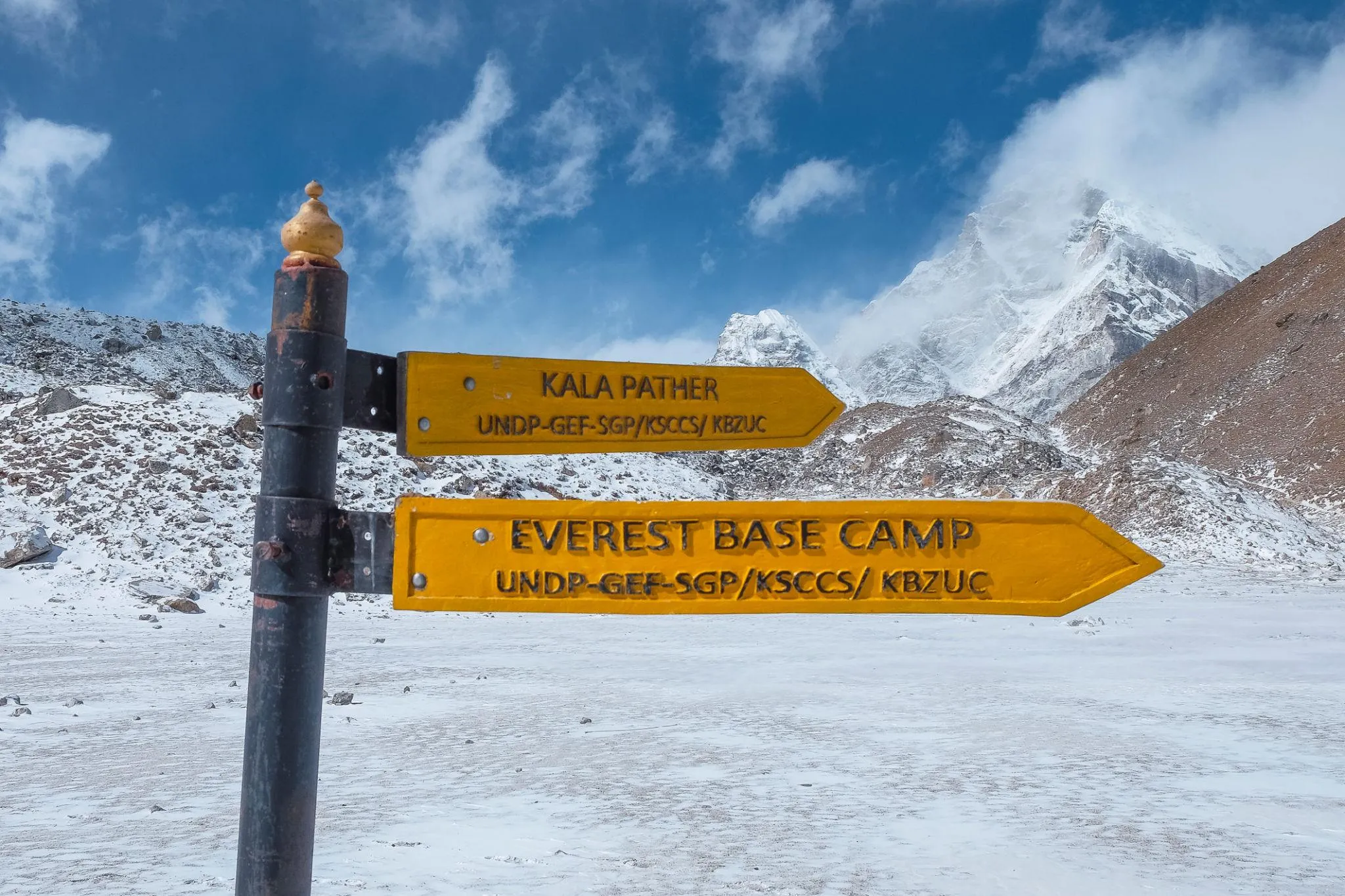
Everest Base Camp Trek – 14 Days to the Foot of Mount Everest

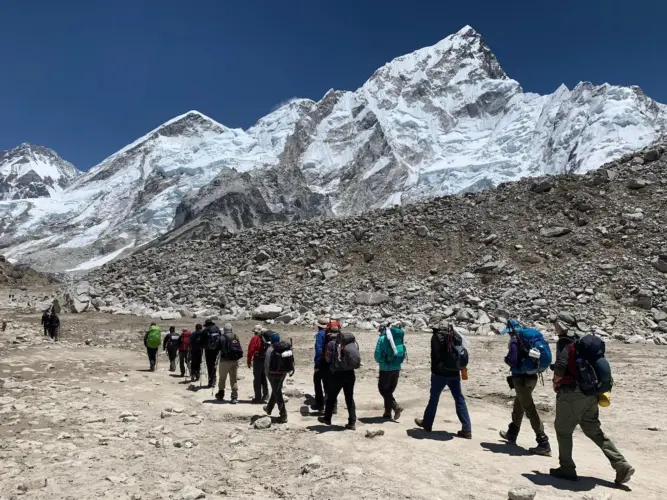
Everest Base Camp TrekThe Everest Base Camp Trek is one of those journeys that stays with you long after you return home. The trail begins in the green hills of the Khumbu and gradually climbs into a landscape of glaciers, high mountain passes, ancient monasteries and enormous Himalayan peaks. Along the way, the villages become smaller, the air becomes thinner, and the mountains begin to dominate every view.

This 14-day Everest Base Camp Trek itinerary is designed around a steady ascent, with dedicated acclimatization days in Namche Bazaar and Dingboche. The route takes you through Lukla, Phakding, Namche Bazaar, Tengboche, Dingboche and Lobuche before reaching Gorakshep and Everest Base Camp at 5,364 metres. You will also climb Kala Patthar for one of the finest sunrise viewpoints in the Khumbu region.

The trek is not simply about reaching Everest Base Camp. It is also about walking through Sherpa villages, crossing suspension bridges over mountain rivers, visiting Buddhist monasteries and experiencing the everyday life of the people who call the Everest region home.

Whether you are travelling with friends, family or a private group, this Everest Base Camp Trek in Nepal offers a memorable combination of adventure, Himalayan scenery and local culture.

Everest Base Camp Trek Highlights

Everest Base Camp Trek Highlights

  • Scenic flight to Lukla and back to Kathmandu
  • Trek through the heart of the Khumbu region
  • Explore the famous mountain town of Namche Bazaar
  • Acclimatization walks with spectacular Himalayan views
  • Visit Tengboche Monastery
  • Walk through traditional Sherpa settlements
  • Views of Everest, Lhotse, Nuptse, Ama Dablam and Thamserku
  • Trek through the Khumbu Glacier region
  • Reach Everest Base Camp
  • Sunrise from Kala Patthar
  • Experience Sagarmatha National Park
  • Cross traditional suspension bridges
  • Private group options and group discounts available
  • 14-day carefully paced itinerary

Everest Base Camp Trek at a Glance

Trek Details Information
Trek Duration 14 Days
Destination Everest Base Camp, Nepal
Maximum Altitude 5,545 m / 18,192 ft
Starting Point Lukla
Ending Point Lukla
Highest Trekking Point Kala Patthar
Base Camp Elevation Approx. 5,364 m / 17,598 ft
Trek Region Khumbu / Everest Region
Difficulty Challenging
Accommodation Hotels in Kathmandu, mountain lodges during trek
Meals Breakfast, Lunch & Dinner during trekking days
Best Seasons Spring and Autumn
Trekking Style Guided Trek
Group Type Private / Group

Why Trek to Everest Base Camp

Why Trek to Everest Base Camp?

There are many high-altitude treks around the world, but the Everest Base Camp Trek has a character of its own.

The route follows trails that have been used for generations by Sherpa communities, mountaineers, porters and travellers heading deeper into the Everest region. The scenery changes dramatically as you climb. Green forests around the lower Khumbu gradually give way to alpine meadows, rocky valleys and glacial landscapes.

Namche Bazaar introduces you to the mountain culture of the region. Tengboche brings you closer to its Buddhist heritage. Dingboche and Lobuche show how life adapts to extreme altitude. Finally, Gorakshep and Everest Base Camp place you among some of the most impressive mountains on Earth.

The journey is physically demanding, but it is the gradual transformation of the landscape that makes the experience so special.

Everest Base Camp Trek Route

Everest Base Camp Trek Route

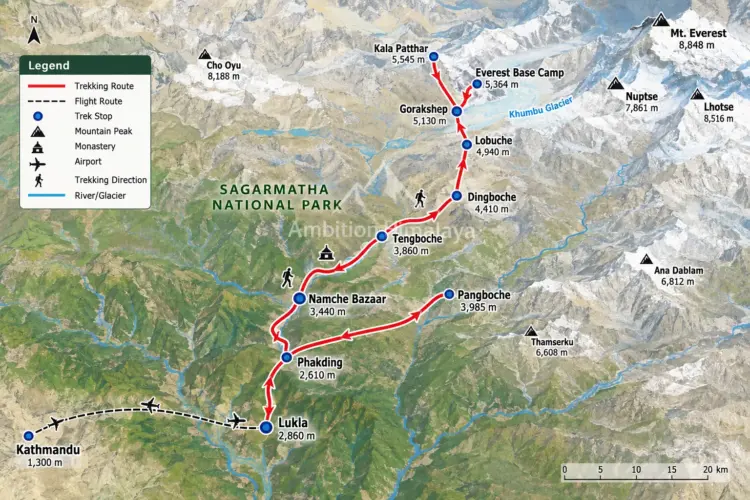
The classic Everest Base Camp Trek route follows a well-established trail through the Khumbu Valley.

After arriving in Kathmandu, you travel towards Lukla and begin trekking towards Phakding. From there, the trail follows the Dudh Koshi River towards Namche Bazaar.

The route then continues through:

Lukla → Phakding → Namche Bazaar → Tengboche → Dingboche → Lobuche → Gorakshep → Everest Base Camp → Kala Patthar → Pangboche → Namche Bazaar → Lukla

The return journey follows a lower route through the Khumbu villages before reaching Lukla for the flight back to Kathmandu.

14-Day Everest Base Camp Trek Itinerary

Day 1: Arrival in Kathmandu – Welcome to Nepal

Altitude: 1,300 m / 4,265 ft
Accommodation: 3-Star Hotel
Meals: Welcome Dinner
Transport: Private vehicle, approximately 30 minutes

Your Everest Base Camp Trek begins in Kathmandu, the vibrant capital of Nepal.

After landing at Tribhuvan International Airport, our representative will meet you outside the arrival area and transfer you to your hotel. Once you have checked in, you can take some time to rest after your journey.

If your energy allows, a short walk around the surrounding streets is a pleasant way to get your first impression of Kathmandu.

Later in the evening, your trekking guide will meet you at the hotel and explain the upcoming journey, including the route, altitude, daily walking schedule and important trekking information.

The day ends with a traditional welcome dinner where you can enjoy some local Nepali cuisine before getting an early night’s rest.

Tomorrow, the mountains begin.

Day 2: Fly to Lukla and Trek to Phakding

Lukla: 2,860 m / 9,383 ft
Phakding: 2,610 m / 8,562 ft
Flight: Approximately 30 minutes
Walking: 3–4 hours
Accommodation: Mountain Lodge
Meals: Breakfast, Lunch & Dinner

An early start takes you towards the airport for your flight to Lukla, the gateway to the Everest region.

During the busiest trekking periods, flights may operate from Ramechhap Airport depending on aviation schedules and operating conditions. If required, you will travel by private vehicle to Ramechhap before continuing by air to Lukla.

The short flight is an exciting introduction to the Himalayas. As the aircraft approaches Lukla, the surrounding hills and mountains gradually replace the city landscape.

After arriving in Lukla, you will have breakfast and prepare for your first walk.

The trail descends gradually through small mountain settlements before reaching Cheplung and continuing towards Ghat. From Ghat, the trail follows the Dudh Koshi River towards Phakding.

This first trekking day is relatively short, allowing your body to begin adjusting to the altitude.

Overnight in Phakding.

Day 3: Phakding to Namche Bazaar

Altitude: 3,440 m / 11,286 ft
Walking: 6–7 hours
Accommodation: Mountain Lodge
Meals: Breakfast, Lunch & Dinner

Today the trail enters deeper into the Everest region.

After breakfast, you follow the Dudh Koshi River through forests and small settlements. The route passes through Benkar before reaching the entrance of Sagarmatha National Park.

Several suspension bridges add an adventurous element to the journey as the trail continues towards Jorsalle.

From here, the route begins climbing more steadily towards Namche Bazaar.

Along the way, you may catch your first distant glimpse of Mount Everest, depending on weather and visibility.

The final climb to Namche is demanding, but arriving in the famous Sherpa town is rewarding. Built into the mountainside, Namche is the commercial and cultural centre of the Khumbu region.

After checking into your lodge, you can relax and enjoy the atmosphere of this remarkable mountain settlement.

Day 4: Acclimatization Day in Namche Bazaar

Altitude: 3,440 m / 11,286 ft
Accommodation: Mountain Lodge
Meals: Breakfast, Lunch & Dinner

Today is an important part of the Everest Base Camp Trek itinerary.

Rather than climbing higher immediately, you spend the day allowing your body to adapt to the increasing altitude.

After breakfast, you can take a gradual hike towards the Everest View area. From the higher viewpoint, the panorama can include Mount Everest, Ama Dablam, Lhotse, Nuptse, Thamserku and other Himalayan peaks.

The area around Namche also provides an opportunity to learn more about Sherpa culture and the history of mountaineering in the Everest region.

You can explore the local market, visit the Sagarmatha National Park Museum or simply spend time enjoying the mountain views.

The purpose of the day is not to remain completely inactive. A short acclimatization hike followed by rest helps prepare you for the higher elevations ahead.

Overnight in Namche Bazaar.

Day 5: Namche Bazaar to Tengboche

Altitude: 3,860 m / 12,664 ft
Walking: 5–6 hours
Distance: Approximately 10 km
Accommodation: Mountain Lodge
Meals: Breakfast, Lunch & Dinner

The trail leaves Namche behind and follows a beautiful mountain route with expansive views across the Khumbu.

After an initial climb, the trail gradually descends towards the Imja Khola before reaching Phungithanga.

From here, the route climbs through forests of rhododendron and other Himalayan vegetation.

The change in scenery is noticeable as the trail moves deeper into the mountains.

Eventually, the forest opens to reveal Tengboche, home to one of the most important Buddhist monasteries in the Everest region.

The panoramic setting is extraordinary, with peaks such as Ama Dablam, Everest, Lhotse, Nuptse and Thamserku visible from the area.

If conditions and monastery schedules permit, you can explore the monastery and experience the peaceful atmosphere of this important spiritual centre.

Overnight in Tengboche.

Day 6: Tengboche to Dingboche

Altitude: 4,410 m / 14,468 ft
Walking: 5–6 hours
Distance: Approximately 8 km
Accommodation: Mountain Lodge
Meals: Breakfast, Lunch & Dinner

The landscape becomes increasingly alpine today.

Leaving Tengboche, the trail descends towards Deboche before crossing the river and continuing towards Pangboche.

Along the route, you will encounter mani walls and traditional Buddhist features that reflect the deep cultural roots of the Khumbu.

The trail gradually climbs towards Dingboche, one of the most important settlements on the higher section of the Everest Base Camp route.

Dingboche is surrounded by impressive Himalayan peaks. Ama Dablam dominates the landscape, while Lhotse and Island Peak can also be seen from different points around the village.

At more than 4,400 metres, the change in altitude is significant, so the evening is best spent resting and preparing for the acclimatization day ahead.

Day 7: Acclimatization Day in Dingboche

Altitude: 4,410 m / 14,468 ft
Accommodation: Mountain Lodge
Meals: Breakfast, Lunch & Dinner

Another acclimatization day gives your body valuable time to adjust before climbing higher.

A common option is a gradual hike towards Nangkartshang Hill. The climb provides wide views across the surrounding valleys and mountains, including dramatic Himalayan peaks such as Makalu and Amphu Lapcha.

The goal is not to rush to the highest point. Walking slowly, spending time at altitude and returning to Dingboche for rest are all part of responsible acclimatization.

The afternoon can be spent relaxing at the lodge or exploring the village.

With the highest part of the trek approaching, this rest day becomes an important milestone in the journey.

Day 8: Dingboche to Lobuche

Altitude: 4,940 m / 16,207 ft
Walking: 4–5 hours
Distance: Approximately 10 km
Accommodation: Mountain Lodge
Meals: Breakfast, Lunch & Dinner

The trail now enters the high Himalayan landscape.

Leaving Dingboche, you follow a scenic route overlooking the Khumbu Valley. The mountains feel much closer here, and the vegetation becomes increasingly sparse.

The route continues towards Dughla before climbing towards the Thukla Pass.

This section of the trail carries a strong emotional significance. Memorials honour climbers and mountaineers who lost their lives in the Himalayas.

After spending some time here, the trail continues through rocky terrain towards Lobuche.

At nearly 5,000 metres, the environment is noticeably different from the lower valleys. Temperatures can drop quickly after sunset, so a warm layer and good sleeping equipment become especially important.

Overnight in Lobuche.

Day 9: Lobuche to Gorakshep and Everest Base Camp

Gorakshep: 5,130 m / 16,830 ft
Everest Base Camp: approximately 5,364 m / 17,598 ft
Walking: 8–9 hours
Accommodation: Mountain Lodge
Meals: Breakfast, Lunch & Dinner

This is one of the most anticipated days of the Everest Base Camp Trek.

The morning begins with a steady walk from Lobuche towards Gorakshep.

The trail becomes increasingly rugged as you move across the high-altitude terrain. Progress is deliberately slow because of the elevation.

Gorakshep is the last major settlement before Everest Base Camp.

After a short break, the journey continues towards Base Camp.

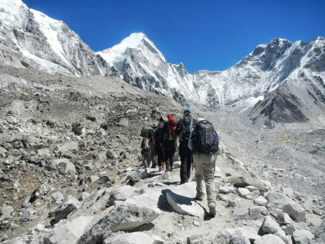
As the trail approaches the destination, the surrounding glacier landscape becomes increasingly dramatic. The Khumbu Icefall, Nuptse, Pumori and Khumbutse create an extraordinary Himalayan backdrop.

Standing at Everest Base Camp is a moment many trekkers remember for the rest of their lives.

There is no road leading here and no easy shortcut. Every step has been earned.

After spending time at Base Camp and taking photographs, you retrace the trail towards Gorakshep.

The evening is kept relaxed because another early start awaits the following morning.

Day 10: Kala Patthar Sunrise and Trek to Pangboche

Kala Patthar: 5,545 m / 18,192 ft
Pangboche: 3,985 m / 13,074 ft
Walking: 9–10 hours
Accommodation: Mountain Lodge
Meals: Breakfast, Lunch & Dinner

An early morning start takes you towards Kala Patthar.

For many trekkers, this is the visual highlight of the entire Everest Base Camp Trek.

The climb takes around two to three hours, depending on pace and conditions. As the sky begins to brighten, the silhouettes of the Himalayan giants slowly become visible.

From Kala Patthar, the panorama can include Mount Everest, Nuptse, Pumori and Ama Dablam.

The early morning light changes the character of the mountains minute by minute.

After enjoying the sunrise, you descend towards Gorakshep for breakfast before beginning the longer descent through the Khumbu.

The trail continues towards Pangboche, where the lower altitude provides a welcome change after spending the previous night above 5,000 metres.

After a long day on the trail, you can finally relax and enjoy a warmer, more comfortable evening.

Day 11: Pangboche to Namche Bazaar

Altitude: 3,440 m / 11,286 ft
Walking: 6–7 hours
Accommodation: Mountain Lodge
Meals: Breakfast, Lunch & Dinner

The return journey feels different.

The same mountains that looked imposing during the ascent now feel familiar. The trail descends through the villages and forests of the Khumbu, passing areas around Tengboche before continuing towards Namche.

As you lose altitude, vegetation gradually becomes thicker.

The walking is generally easier than the high-altitude sections, although the long downhill stretches can still be tiring.

By the time you arrive in Namche Bazaar, you will have completed the most demanding part of the trek.

A warm meal, comfortable lodge and familiar surroundings make this evening especially enjoyable.

Day 12: Namche Bazaar to Lukla

Altitude: 2,860 m / 9,383 ft
Walking: 6–7 hours
Distance: Approximately 20 km
Accommodation: Mountain Lodge
Meals: Breakfast, Lunch & Dinner

Your final trekking day follows the trail back towards Lukla.

You descend through the forests and settlements that you passed during the first part of the journey.

The trail crosses the Dudh Koshi and Bhote Koshi river systems before reaching Phakding, where you can stop for lunch.

From Phakding, the route continues towards Lukla.

Although the path is familiar, the feeling is different. You are no longer wondering what lies around the next corner; instead, you can look back on the journey you have just completed.

Once in Lukla, you can relax, explore the town and perhaps pick up a small souvenir to remember your time in the Everest region.

Day 13: Fly from Lukla to Kathmandu

Flight: Approximately 30 minutes
Accommodation: 3-Star Hotel
Meals: Breakfast

After breakfast, you head towards Lukla Airport for your return flight to Kathmandu.

The short flight offers another opportunity to see the mountain landscape from above before returning to the Kathmandu Valley.

Once you arrive in Kathmandu, you can check into your hotel and enjoy a hot shower and some well-earned rest.

After nearly two weeks in the mountains, the comforts of the city can feel surprisingly luxurious.

The rest of the day is free for relaxation, shopping or exploring Kathmandu depending on your energy and schedule.

Day 14: Final Departure from Nepal

Transport: Private vehicle
Meals: Breakfast

Your 14-day Everest Base Camp Trek comes to an end today.

After breakfast, our representative will transfer you to Tribhuvan International Airport for your onward flight.

If you have additional time in Nepal, your journey does not have to end here.

Nepal offers many other experiences, including wildlife safaris, cultural tours, scenic mountain journeys, rafting adventures and other Himalayan trekking routes.

Until the next journey, the memories of the Everest region, Sherpa villages, suspension bridges, monasteries and Himalayan sunrise remain with you.

Everest Base Camp Trek Difficulty

Everest Base Camp Trek Difficulty

The Everest Base Camp Trek is considered a challenging high-altitude trek.

You do not need to be an elite athlete, but you should be comfortable walking for several hours on consecutive days. The biggest challenge is not simply the distance. Altitude, uneven terrain, changing weather and long ascents all contribute to the difficulty.

Some trekking days can involve 6–9 hours of walking, while the Everest Base Camp and Kala Patthar sections can feel particularly demanding.

Regular cardiovascular exercise, hill walking, stair climbing and long-distance walking before the trek can help you prepare.

Most importantly, the itinerary allows acclimatization days in Namche Bazaar and Dingboche.

Best Time for the Everest Base Camp Trek

The main trekking seasons are spring and autumn.

Spring – March to May

Spring brings generally stable trekking conditions, clear mountain views and pleasant daytime temperatures. The rhododendron forests can also add colour to the lower sections of the trail.

Autumn – September to November

Autumn is another popular period for the Everest Base Camp Trek. The monsoon season has usually passed, leaving clearer skies and excellent visibility.

Winter – December to February

Winter brings colder temperatures and more challenging conditions at higher elevations. Snow and freezing temperatures can make the trek considerably harder.

Monsoon – June to August

The monsoon season brings more rain to lower areas and can affect mountain flights and trail conditions.

Weather in the Himalayas can change quickly regardless of season, so trekking plans should always allow some flexibility.

Everest Base Camp Trek Cost and Private Group Discounts

The cost of an Everest Base Camp Trek depends on the trekking style, accommodation, meals, guide and porter arrangements, permits, transportation and group size.

Private groups can also receive different per-person rates depending on the number of travellers.

Private Group Discount

No. of People Price Per Person
1 Pax US$1,450
2 Pax US$1,320
3–5 Pax US$1,280
6–9 Pax US$1,230
10–15 Pax US$1,180
16+ Pax US$1,130

Private group discounts are available for larger groups.

For groups travelling together, the per-person cost can become more economical as the group size increases. Final pricing may depend on travel dates, flight arrangements, accommodation and selected services.

What Makes This Everest Base Camp Trek Different?

A trek to Everest is not measured only by the final destination.

The journey begins among the streets of Kathmandu and slowly moves into a completely different world. Lukla introduces the mountains. Namche introduces Sherpa culture. Tengboche introduces the spiritual side of the Khumbu. Dingboche marks the transition into a harsher alpine environment.

By the time you reach Everest Base Camp, you have already travelled through several distinct landscapes.

That progression is what makes the Everest Base Camp Trek in Nepal such a rewarding experience.

Accommodation During the Trek

Accommodation during the trekking portion is generally provided in mountain lodges and teahouses.

Rooms are usually simple and comfortable, with the emphasis being on warmth, rest and a good night’s sleep rather than luxury.

Kathmandu accommodation is provided in a comfortable hotel, while mountain lodges offer a more authentic experience of life in the Khumbu.

At higher elevations, facilities become more basic, which is part of the character of trekking in the Everest region.

Meals During the Everest Base Camp Trek

Meals during the trek are designed to provide enough energy for long days of walking.

Typical menus can include:

  • Dal Bhat
  • Rice and vegetable dishes
  • Noodles
  • Pasta
  • Soups
  • Potatoes
  • Eggs
  • Tibetan-style bread
  • Momos
  • Porridge
  • Tea and coffee

Dal Bhat remains one of the most popular trekking meals in Nepal because it is filling and provides a useful combination of carbohydrates and protein.

What Should You Pack for Everest Base Camp?

Packing correctly can make a major difference during a high-altitude trek.

Essential items generally include:

  • Waterproof trekking boots
  • Warm down jacket
  • Thermal base layers
  • Fleece jacket
  • Waterproof jacket and trousers
  • Trekking trousers
  • Warm gloves
  • Wool or thermal socks
  • Sun hat
  • Warm hat
  • Sunglasses
  • Sunscreen
  • Reusable water bottle
  • Headlamp
  • Trekking poles
  • Sleeping bag suitable for cold conditions
  • Personal first-aid supplies
  • Backpack and daypack
  • Power bank
  • Basic toiletries

Avoid carrying unnecessary weight. A lighter backpack makes long trekking days considerably more comfortable.

Is Everest Base Camp Safe?

The Everest Base Camp route is a well-established trekking trail, but it is still a high-altitude mountain environment.

Weather can change rapidly, flights may be delayed, and altitude can affect trekkers differently.

Following the guide’s instructions, maintaining a sensible walking pace, staying hydrated and taking acclimatization seriously are important parts of a safe trek.

If you develop symptoms that may indicate altitude illness, inform your guide immediately rather than trying to push through them.

Mountain safety should always take priority over maintaining a fixed schedule.

Frequently Asked Questions

How many days does the Everest Base Camp Trek take?

This itinerary takes 14 days, including arrival and departure days in Kathmandu, the trek to Everest Base Camp, Kala Patthar and the return to Lukla.

What is the highest point of the trek?

The highest point on this itinerary is Kala Patthar at approximately 5,545 metres (18,192 ft).

How high is Everest Base Camp?

Everest Base Camp on the Nepal side is approximately 5,364 metres (17,598 ft) above sea level.

Is the Everest Base Camp Trek difficult?

Yes. It is a challenging high-altitude trek requiring good physical preparation and proper acclimatization. However, you do not need technical mountaineering experience to complete the standard trekking route.

Do I need previous trekking experience?

Previous trekking experience is useful but not essential. Being physically prepared for long walking days is more important.

Can I do the Everest Base Camp Trek privately?

Yes. A private Everest Base Camp Trek can be arranged for individuals, couples, families and groups.

Are group discounts available?

Yes. Private group pricing is available, with the per-person rate generally decreasing as the group size increases.

What is the best season for Everest Base Camp?

Spring and autumn are generally considered the main trekking seasons because of favourable conditions and mountain visibility.

Where does the Everest Base Camp Trek start?

The classic route begins with a flight to Lukla, followed by trekking through Phakding, Namche Bazaar, Tengboche, Dingboche and Lobuche.

Can flights to Lukla be delayed?

Yes. Mountain weather can affect flight operations. It is sensible to keep some flexibility in your travel schedule when planning an Everest Base Camp journey.

Your Everest Journey Starts Here

The Everest Base Camp Trek is more than a walk towards the world’s highest mountain.

It is the sound of prayer flags moving in the mountain wind, the first glimpse of Ama Dablam rising above the valley, the rhythm of footsteps across suspension bridges, and the simple warmth of a cup of tea after a long day on the trail.

It is the peaceful surroundings of Tengboche, the stone-built villages of Dingboche, the memorials at Thukla and the growing excitement as Everest Base Camp comes closer.

Then comes Kala Patthar — standing high above the Khumbu, watching the first light of morning touch Everest and the surrounding Himalayan peaks.

For 14 days, the mountains become your surroundings, the trail becomes your routine, and every village, viewpoint and mountain pass becomes part of a journey you will remember for years.

If Everest has been on your travel list for years, perhaps it is time to experience the journey for yourself — one step at a time.

Plan Your Everest Base Camp Trek with Ambition Himalaya

Whether you are travelling solo, as a couple, with friends or as a private group, Ambition Himalaya can help you plan your Everest Base Camp journey with experienced local guides, carefully arranged logistics and a thoughtfully planned trekking itinerary.

Get in touch with us to discuss your trekking dates, group size and travel requirements.

Email: [email protected]
Phone: +977 1 4518413
Mobile / WhatsApp: +977 9851148898
Office: Thamel-26, Kathmandu, Nepal
Website: ambitionhimalaya.com

Ambition Himalaya

Your Journey to the Himalayas Begins Here.
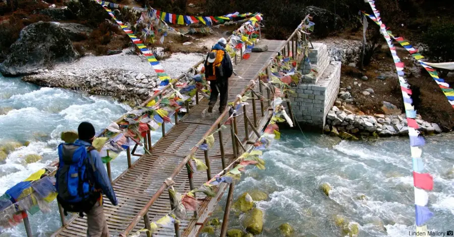
Annapurna Circuit Trek Packing List 2026: Complete Gear Guide

Annapurna Circuit Trek

Planning the Annapurna Circuit Trek in 2026? One of the most important things to prepare before arriving in Nepal is your trekking gear.

The Annapurna Circuit is different from many shorter Himalayan treks because the trail passes through several distinct environments. You may begin the journey in a relatively warm valley and gradually climb toward high-altitude landscapes, eventually reaching Thorong La Pass at 5,416 metres (17,769 feet).

That means your backpack needs to be prepared for changing temperatures, strong mountain winds, rain, cold mornings and potentially snow around the highest sections of the trail.

At Ambition Himalaya, we recommend packing smart rather than simply packing more. The goal is to carry everything you genuinely need while keeping your backpack manageable throughout the trek.

This Annapurna Circuit Trek Packing List 2026 explains what to bring, what you can rent in Nepal, what you should keep in your daypack, and which items you can safely leave behind.

Annapurna Circuit Trek Packing List at a GlanceAnnapurna Circuit Trek Packing List at a Glance

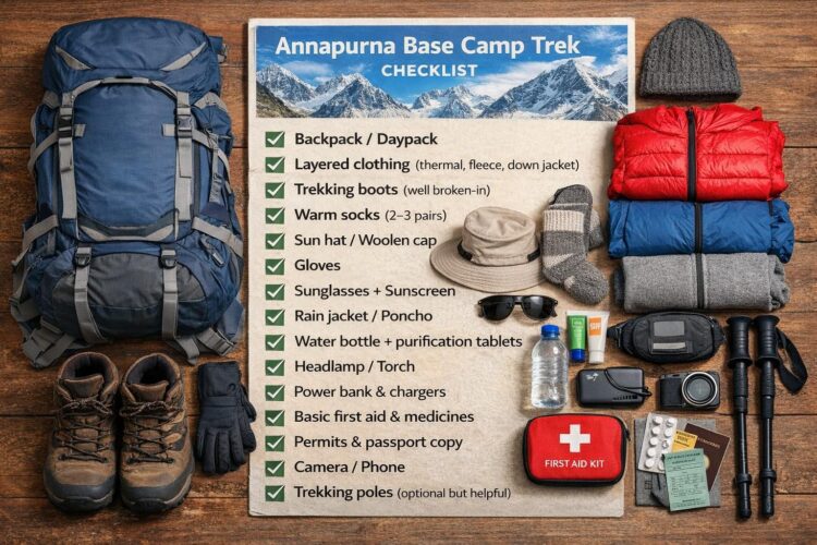
Before going into every category, here is a quick checklist of the essential equipment.

Clothing

  • Moisture-wicking trekking T-shirts
  • Thermal base layers
  • Trekking trousers
  • Fleece jacket
  • Insulated/down jacket
  • Waterproof and windproof jacket
  • Waterproof trekking trousers
  • Warm hat
  • Sun hat or cap
  • Buff or neck gaiter
  • Trekking socks
  • Warm gloves
  • Underwear

Footwear

  • Comfortable trekking boots
  • Camp shoes or sandals
  • Trekking socks
  • Gaiters if travelling during snowy conditions

Trekking Gear

  • 25–40 litre daypack
  • Duffel bag if using a porter
  • Rain cover
  • Trekking poles
  • Headlamp
  • Water bottles or hydration system
  • Sleeping bag
  • Sleeping bag liner

Personal Essentials

  • Passport
  • Trekking permits and documents
  • Travel insurance details
  • Cash in Nepalese Rupees
  • Sunglasses
  • Sunscreen
  • Lip balm with SPF
  • Personal toiletries
  • Small towel

Health & Safety

  • Personal medication
  • Basic first-aid kit
  • Blister treatment
  • Oral rehydration salts
  • Water purification tablets/filter
  • Personal altitude medication prescribed by your doctor

Electronics

  • Smartphone
  • Camera
  • Power bank
  • Charging cables
  • Universal travel adapter
  • Spare batteries where required

Annapurna Circuit Trek Packing List at a Glance

Why Packing Correctly Matters on the Annapurna Circuit

The Annapurna Circuit covers a dramatic range of elevations and landscapes. Lower sections can feel warm during the day, while the higher areas around Thorong La can become extremely cold, especially during early-morning crossings.

This is why a simple “summer clothes + one jacket” approach is not suitable.

The most useful strategy is layering.

Instead of carrying one extremely heavy jacket for every situation, use several layers that can be added or removed according to the temperature.

A practical layering system consists of:

Base layer → fleece/insulation → down jacket → waterproof/windproof outer shell

This gives you flexibility without unnecessarily increasing your pack weight.

1. Base Layers and Trekking Shirts

Your base layer sits directly against your skin and should move moisture away from your body.

Pack:

  • 2–3 quick-drying T-shirts
  • 1–2 thermal long-sleeve tops
  • 1–2 thermal bottoms
  • 4–5 pairs of trekking underwear

Merino wool or good-quality synthetic fabrics are preferable because they dry faster and manage moisture better than cotton.

Avoid Cotton

Cotton absorbs moisture and takes longer to dry.

On a Himalayan trek, wet clothing can become uncomfortable and cold very quickly.

For that reason, lightweight synthetic or merino clothing is generally more practical.

2. Trekking Trousers and Lower-Body Clothing

A pair of comfortable trekking trousers is one of the most frequently used items on the trail.

We recommend:

  • 2 pairs of trekking trousers
  • 1 lightweight pair of thermal bottoms
  • 1 optional lightweight short
  • Waterproof trekking trousers

Convertible trekking trousers can be useful in warmer lower sections.

As you gain elevation, however, long trousers and thermal layers become increasingly useful.

3. Fleece Jacket or Mid-Layer

A fleece jacket provides an important insulation layer without adding excessive weight.

A lightweight or medium-weight fleece is usually enough for everyday trekking conditions.

It can be worn:

  • During cool mornings
  • In shaded sections
  • Around higher villages
  • Inside teahouses during cold evenings

The advantage of fleece is that it works well as part of a layering system.

4. Down or Insulated Jacket

A proper insulated jacket is one of the most important pieces of equipment for the high sections of the Annapurna Circuit.

Temperatures can fall significantly around high camps and during early-morning sections of the Thorong La crossing.

Choose a jacket that:

  • Provides sufficient insulation
  • Packs reasonably small
  • Fits comfortably over your base and fleece layers
  • Protects you from cold mountain conditions

If you do not own a suitable down jacket, renting one in Kathmandu or Pokhara can be a practical option.

5. Waterproof and Windproof Jacket

Do not rely only on your down jacket for weather protection.

A lightweight waterproof shell provides protection against:

  • Rain
  • Snow
  • Strong wind
  • Sudden weather changes

Your outer shell should fit comfortably over your insulation layers.

A waterproof jacket is particularly useful because weather conditions in the mountains can change quickly.

6. Trekking Boots

Your trekking boots are arguably one of the most important items you will bring.

Choose boots that:

  • Are comfortable
  • Have good grip
  • Provide suitable ankle support
  • Are already broken in
  • Fit correctly with your trekking socks

Never Start the Trek With Brand-New Boots

Breaking in your boots before the trek can significantly reduce the possibility of painful hot spots and blisters.

Your boots should be comfortable before you arrive in Nepal.

7. Trekking Socks

Bring around 4–5 pairs of good-quality trekking socks.

Merino wool or technical synthetic socks are useful because they provide warmth while managing moisture.

Avoid wearing wet socks for long periods.

A simple habit that helps is keeping one dry pair specifically for evenings at the teahouse.

8. Trekking Poles

Trekking poles are optional, but many trekkers find them extremely useful on the Annapurna Circuit.

They can help with:

  • Long ascents
  • Uneven trails
  • Rocky sections
  • Descents
  • Reducing stress on knees

They become particularly useful during long downhill sections after crossing Thorong La.

If you are not travelling with poles, they can generally be purchased or rented in Nepal.

9. Backpack and Duffel Bag

If you are using a porter, you normally do not need to carry your entire trekking wardrobe on your back.

A practical setup is:

Your Daypack

Approximately 25–40 litres, depending on how much you prefer to carry yourself.

Keep essential items accessible:

  • Water
  • Snacks
  • Waterproof jacket
  • Down jacket
  • Gloves
  • Hat
  • Sunglasses
  • Sunscreen
  • Camera
  • Documents
  • Medication
  • Power bank

Porter Duffel

Your main clothing and less frequently used equipment can go into a soft duffel bag.

Always keep important documents, valuables, electronics and essential medication with you rather than inside your porter bag.

10. Sleeping Bag

A warm sleeping bag can make a major difference to your comfort during the colder nights.

For the Annapurna Circuit, especially when travelling through the colder months or crossing the higher sections, choose a sleeping bag appropriate for the expected temperatures.

If you do not want to purchase one specifically for a single trek, sleeping bags are available for rent in Kathmandu and Pokhara.

The exact warmth required depends on your travel season, route variation and accommodation conditions.

11. Headlamp

A lightweight headlamp is an essential item.

It is useful for:

  • Early morning starts
  • Walking around the teahouse after dark
  • Power cuts
  • Preparing for a pre-dawn high-pass crossing

Bring spare batteries or make sure the rechargeable headlamp is fully charged before the trek.

12. Sunglasses and Sun Protection

High-altitude sunlight can be intense.

Your packing list should include:

  • UV-protection sunglasses
  • Sunscreen, preferably SPF 30–50+
  • SPF lip balm
  • Sun hat or cap
  • Buff or neck protection

Sunglasses become particularly important around exposed high-altitude terrain and snow because reflected sunlight can be uncomfortable and potentially harmful to your eyes.

13. Water and Hydration

Staying hydrated is important throughout the trek.

Carry:

  • Reusable water bottles
  • Water purification tablets or a suitable filter
  • Optional hydration bladder

A total carrying capacity of around 2 litres or more can be useful depending on the day’s route and water availability.

Avoid depending entirely on buying bottled water every day.

A reusable system is more convenient and helps reduce plastic waste along the trail.

14. Personal First-Aid Kit

You do not need to carry a large medical bag.

A compact personal kit can include:

  • Blister treatment
  • Adhesive bandages
  • Antiseptic wipes
  • Gauze
  • Pain-relief medication that you normally use
  • Oral rehydration salts
  • Personal prescription medicines
  • Any medication specifically prescribed for altitude by your doctor

If you have an existing medical condition or take prescription medication, speak with your doctor before travelling.

Altitude Awareness

The Annapurna Circuit reaches a significant altitude, particularly around Thorong La.

Knowing the symptoms of altitude sickness is more important than simply carrying medication.

If you develop concerning symptoms at altitude, tell your guide immediately and follow professional medical advice.

15. Toiletries and Personal Hygiene

Keep your toiletries lightweight.

Useful items include:

  • Toothbrush and toothpaste
  • Biodegradable soap
  • Small shampoo
  • Hand sanitizer
  • Wet wipes
  • Small quick-drying towel
  • Toilet paper or tissues
  • Moisturizer
  • Sunscreen
  • Lip balm

A small toiletry bag is enough.

There is no reason to carry full-size bottles of everything.

16. Electronics and Charging

Bring only the electronics you genuinely need.

Recommended:

  • Smartphone
  • Camera
  • Charging cable
  • Power bank
  • Universal adapter
  • Spare camera batteries

A 10,000–20,000 mAh power bank can be useful during a longer trek, particularly when charging availability becomes limited or inconvenient.

Keep electronic equipment protected from moisture.

17. Documents and Money

Keep your important documents safely accessible.

Carry:

  • Passport
  • Copies of important documents
  • Trekking permit information
  • Travel insurance documents
  • Emergency contact information
  • Nepalese cash

Do not keep all of your cash in a single location.

Your travel insurance should specifically cover trekking at the altitude relevant to your itinerary.

18. Snacks for the Trail

You can buy food along much of the Annapurna Circuit, but carrying a few personal snacks is useful.

Good options include:

  • Energy bars
  • Nuts
  • Chocolate
  • Dried fruit
  • Electrolyte sachets

Choose compact, high-energy foods that you actually enjoy eating.

19. What to Pack for Thorong La Pass

The Thorong La Pass at 5,416 metres is one of the most demanding parts of the Annapurna Circuit.

For the pass day, keep your warmest and most important equipment immediately accessible.

Your daypack should include:

  • Insulated/down jacket
  • Warm gloves
  • Warm hat
  • Thermal layer
  • Waterproof/windproof shell
  • Headlamp
  • Sunglasses
  • Water
  • Snacks
  • Personal medication
  • Sunscreen
  • Phone/camera
  • Power bank

Do not bury essential cold-weather equipment inside the main porter duffel.

20. What to Pack by Season

Spring: March to May

Spring generally brings a combination of cool mornings, warmer daytime temperatures and changing conditions at higher elevations.

Pack:

  • Lightweight layers
  • Fleece
  • Insulated jacket
  • Rain protection
  • Sun protection
  • Warm sleeping bag

Higher sections can still be very cold, so do not pack only for the lower valley.

Monsoon: June to August

The monsoon period requires additional rain protection.

Consider:

  • Waterproof jacket
  • Waterproof trousers
  • Backpack rain cover
  • Dry bags
  • Quick-drying clothing
  • Extra socks
  • Waterproof protection for electronics

Trail and weather conditions can vary considerably during this period.

Check current local conditions before departure.

Autumn: September to November

Autumn is a popular period for trekking in Nepal.

You should still prepare for cold conditions at higher elevations.

Pack:

  • Base layers
  • Fleece
  • Down/insulated jacket
  • Waterproof shell
  • Warm gloves
  • Hat
  • Sleeping bag
  • Strong sun protection

Clear weather does not mean the high-altitude sections will be warm.

Winter: December to February

Winter requires greater attention to cold-weather equipment.

Consider:

  • Warmer sleeping bag
  • Good insulated jacket
  • Thermal base layers
  • Warm gloves
  • Warm hat
  • Gaiters
  • Appropriate footwear
  • Additional cold-weather layers

Snow and trail conditions can vary, so always check current conditions with your trekking agency and guide before attempting a high-pass crossing.

What NOT to Pack for the Annapurna Circuit

Overpacking is one of the most common mistakes on a long Himalayan trek.

You can usually leave these items behind:

  • Heavy jeans
  • Too many T-shirts
  • Large bottles of shampoo
  • Excessive cosmetics
  • Multiple pairs of casual shoes
  • Expensive jewellery
  • Unnecessary electronics
  • Heavy books
  • Large towels
  • Duplicate jackets
  • Clothing you are unlikely to wear

Remember:

Every unnecessary kilogram becomes part of your journey.

Pack fewer items, but make sure the important ones are reliable.

What Can You Rent in Kathmandu or Pokhara?

You do not necessarily need to purchase every piece of trekking equipment before arriving in Nepal.

Depending on availability, commonly rented equipment can include:

  • Down jackets
  • Sleeping bags
  • Trekking poles
  • Duffel bags
  • Some trekking accessories

Renting can be particularly useful if you only trek occasionally and do not want to purchase bulky cold-weather equipment.

At Ambition Himalaya, we can also advise you about the equipment required for your specific itinerary and season before your trek begins.

A Practical Annapurna Circuit Packing Checklist

Clothing

☐ 2–3 trekking T-shirts
☐ 1–2 thermal tops
☐ 1–2 thermal bottoms
☐ 2 trekking trousers
☐ Fleece jacket
☐ Down/insulated jacket
☐ Waterproof jacket
☐ Waterproof trousers
☐ 4–5 pairs trekking socks
☐ Warm hat
☐ Sun hat
☐ Gloves
☐ Buff
☐ Underwear

Footwear

☐ Broken-in trekking boots
☐ Camp shoes/sandals
☐ Gaiters if required

Trekking Equipment

☐ Daypack
☐ Duffel bag
☐ Backpack rain cover
☐ Trekking poles
☐ Headlamp
☐ Sleeping bag
☐ Water bottles
☐ Water purification system

Health

☐ Personal medication
☐ First-aid kit
☐ Blister treatment
☐ ORS/electrolytes
☐ Sunscreen
☐ SPF lip balm

Electronics

☐ Smartphone
☐ Camera
☐ Power bank
☐ Charging cables
☐ Travel adapter
☐ Spare batteries

Documents

☐ Passport
☐ Permit documents
☐ Travel insurance
☐ Emergency contacts
☐ Nepalese cash

Frequently Asked Questions

How much should I pack for the Annapurna Circuit Trek?

Try to keep your equipment practical and lightweight. If you use a porter, keep the main bag manageable and carry only essential daily items in your daypack.

The exact weight depends on your personal needs, season and whether you use a porter.

Do I need a sleeping bag for the Annapurna Circuit?

A sleeping bag is strongly recommended, particularly for colder seasons and higher elevations. You can also consider renting one in Kathmandu or Pokhara.

Do I need a down jacket for Thorong La?

A warm insulated jacket is an important part of your high-altitude clothing system. The correct warmth level depends on the season and current conditions.

Can I rent trekking equipment in Nepal?

Yes. Kathmandu and Pokhara have trekking shops where travellers can commonly rent items such as sleeping bags, down jackets, trekking poles and duffel bags.

What shoes should I wear for the Annapurna Circuit?

Use comfortable, properly broken-in trekking boots with good grip. Avoid starting a long trek with brand-new footwear.

Do I need trekking poles?

They are optional, but many trekkers find them useful, especially on steep descents and uneven terrain.

What should I carry in my daypack?

Keep water, snacks, rain protection, warm layers, sunglasses, sunscreen, medication, documents, electronics and other essential items you may need during the day.

Is the Annapurna Circuit cold?

Temperatures vary significantly depending on altitude, season and time of day. Lower sections can be relatively warm while the high-altitude sections around Thorong La can be very cold.

What is the most important thing to remember when packing?

Pack according to the highest and coldest part of your itinerary, not only the conditions you expect at the beginning of the trek.

Pack Smart. Trek Confidently.

The Annapurna Circuit is one of Nepal’s most varied trekking journeys, taking you through changing landscapes, mountain villages, high-altitude terrain and the dramatic Thorong La Pass.

You do not need the biggest backpack or the most expensive equipment.

You need the right equipment for your route, season and altitude.

At Ambition Himalaya, our trekking team can help you understand what you actually need before starting your Annapurna Circuit adventure. From itinerary planning and trekking preparation to experienced local guides and logistical support, we aim to make your Himalayan journey organized and comfortable.

Planning your Annapurna Circuit Trek in 2026?

Explore the Annapurna Circuit Trek with Ambition Himalaya and speak with our team about your preferred itinerary, season and trekking requirements.

Ambition Himalaya – Your Local Partner for Himalayan Adventures in Nepal.

Mera Peak Climbing 17 Days: Complete Itinerary & Summit Guide

Mera Peak Climbing 17 DaysMera Peak Climbing – 17 Days: A Complete Journey to Nepal’s High Himalayan Summit

Standing at 6,476 metres (21,246 ft), Mera Peak is one of the most rewarding high-altitude climbing adventures in Nepal. The journey combines remote Himalayan trails, quiet mountain villages, long trekking days and a genuine summit experience in the high mountains.

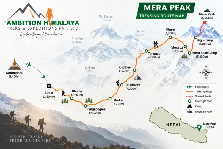
The 17-day Mera Peak Climbing itinerary by Ambition Himalaya is designed for travellers who want more than a conventional trek. The route begins in Kathmandu, flies towards Lukla and gradually enters the remote Hinku Valley before reaching Khare and Mera High Camp. The summit attempt is made early in the morning, followed by the return journey through the mountain trails to Lukla and finally Kathmandu.

Mera Peak is part of Nepal’s trekking-peak climbing environment, where appropriate climbing skills, equipment, permits and experienced mountain support are important. Nepal Tourism Board notes that Nepal’s trekking peaks require climbing skills and proper climbing equipment and should not be underestimated simply because they are classified as trekking peaks.

For travellers looking for a challenging but achievable Himalayan climbing experience, Mera Peak Climbing offers an impressive combination of adventure, altitude, mountain scenery and cultural experience.

Mera Peak Climbing at a Glance

                                Mera Peak Climbing at a Glance

Trip Detail Information
Trip Name Mera Peak Climbing
Duration 17 Days
Maximum Elevation 6,476m / 21,246ft
Starting Point Kathmandu
Trekking Start Lukla
Summit Mera Peak
Main Valley Hinku Valley
Highest Camp Mera High Camp
Summit Day Day 10
Difficulty Challenging high-altitude climb
Accommodation Hotels and mountain lodges/teahouses
Best Seasons Spring and autumn are generally preferred
Company Ambition Himalaya

Official trip page: Mera Peak Climbing – Ambition Himalaya

Why Choose Mera Peak Climbing

Why Choose Mera Peak Climbing?

Mera Peak offers a very different experience from simply trekking to a Himalayan viewpoint. You spend several days walking through changing landscapes before entering the higher alpine environment, where the character of the journey changes completely.

The lower part of the route takes you through forests and traditional mountain trails. As you gain altitude, the vegetation becomes thinner, the landscape becomes more rugged and the surrounding mountains become increasingly dominant.

Eventually, the trail reaches Khare, where the focus shifts from trekking to climbing preparation.

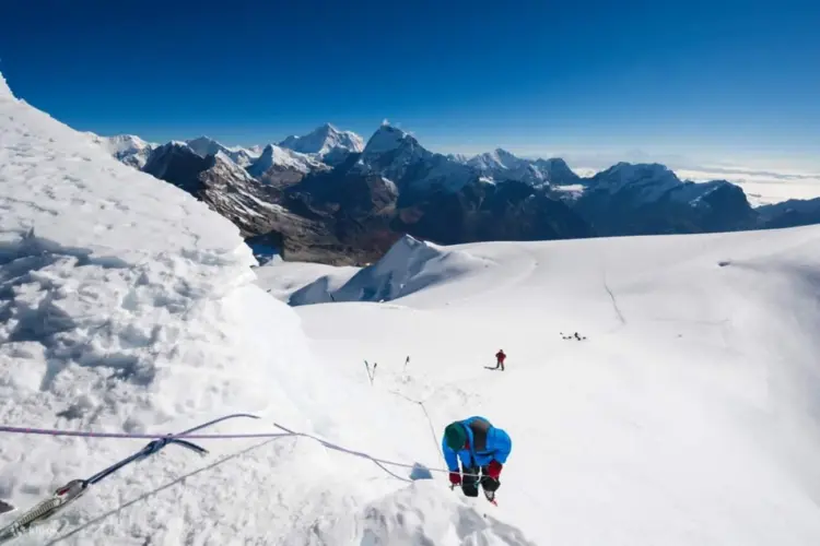
The summit day is the defining moment of the journey. An early start allows climbers to make progress during the colder and generally more stable morning hours before returning to lower elevations.

From the summit, the Himalayan panorama is one of the great rewards of the climb, with views across the high peaks of the Khumbu and surrounding Himalayan ranges.

Mera Peak Map

Mera Peak Climbing 17 Days – Complete Day-to-Day Itinerary

Day 1: Arrival in Kathmandu – Transfer to Hotel

Your Mera Peak adventure begins with your arrival in Kathmandu, Nepal’s vibrant capital city.

After completing the airport formalities, you will be transferred to your hotel. This first day is intentionally kept relaxed, allowing you to recover from your journey and settle into the Himalayan atmosphere.

Kathmandu is a fascinating mixture of ancient culture and modern city life. Depending on your arrival time, you may have an opportunity to explore the surrounding streets, enjoy traditional Nepali food or simply rest before the trekking and climbing journey begins.

Overnight: Kathmandu
Altitude: 1,300m

Day 2: Kathmandu – Trek and Climb Preparation

Day two is dedicated to preparation.

There is time to review your trekking and climbing equipment, organize your bags and complete the necessary preparations for the journey into the Everest region.

This is also an important opportunity to make sure that your clothing, footwear, climbing equipment and personal essentials are suitable for the changing conditions you will encounter.

For a high-altitude trip like Mera Peak, preparation is not something to leave until the last moment. Your guide and climbing team can help identify equipment requirements and make sure everything needed for the higher sections of the route is ready.

You may also have free time to explore Kathmandu or purchase any last-minute trekking supplies.

Overnight: Kathmandu

Day 3: Fly from Kathmandu to Lukla and Trek to Chhutanga

The adventure properly begins with an early flight towards Lukla.

The flight takes approximately 30 minutes, followed by the beginning of the trek towards Chhutanga.

Nepal Tourism Board describes Lukla as one of the main gateways to the Everest region and notes that the flight from Kathmandu is approximately 30 minutes.

The first walking section introduces you to the Himalayan trail. After leaving Lukla, the surroundings gradually become quieter as you move away from the airport and settlements.

The walk to Chhutanga takes approximately 3–4 hours, depending on trail conditions and the pace of the group.

Walking: 3–4 hours
Flight: Approximately 30 minutes
Destination: Chhutanga

Day 4: Chhutanga to Tuli Kharka

Today the trail becomes more demanding.

The route from Chhutanga to Tuli Kharka, at approximately 4,100m, involves a substantial increase in elevation. This section of the journey is important because the body begins adjusting to the higher Himalayan environment.

The trail passes through mountain terrain with changing vegetation and impressive views as you gradually move deeper into the remote landscape.

The walking time is approximately 5–6 hours.

A steady pace is more valuable than trying to walk quickly. At this stage of the itinerary, conserving energy and allowing your body to adapt to altitude are important parts of the climb.

Trek: Chhutanga → Tuli Kharka
Altitude: Approximately 4,100m
Walking: 5–6 hours

Day 5: Tuli Kharka to Kothe

The journey continues towards Kothe.

Today’s trail takes approximately 6–7 hours, passing through the rugged landscape of the Hinku Valley region.

The scenery gradually changes as the route moves further into the mountains. The trail feels increasingly remote, and the surrounding peaks become a constant presence.

Kothe is an important stop on the Mera Peak route because it provides a chance to rest before the itinerary continues towards Thangnak and eventually Khare.

Trek: Tuli Kharka → Kothe
Altitude: Approximately 4,182m
Walking: 6–7 hours

Day 6: Kothe to Thangnak

After breakfast, the trek continues towards Thangnak, located at approximately 4,350m.

Compared with the previous day, the walking distance is shorter, with around 4–5 hours on the trail.

This is a beautiful section of the journey, with the surrounding mountain landscape becoming more dramatic as you gain altitude.

The slower pace is intentional. At these elevations, every additional metre of altitude has an effect on the body, and gradual acclimatization becomes increasingly important.

Trek: Kothe → Thangnak
Altitude: 4,350m
Walking: 4–5 hours

Day 7: Thangnak to Khare

Today’s destination is Khare, situated at approximately 5,045m.

The trek takes around 4–5 hours, but the altitude makes this section considerably more demanding than the number of walking hours might suggest.

Khare is an important location in the Mera Peak climbing itinerary because the journey now moves firmly into the high-altitude climbing phase.

The surrounding environment becomes increasingly alpine, with fewer trees and a much more exposed mountain landscape.

Once you reach Khare, rest becomes particularly important.

Trek: Thangnak → Khare
Altitude: 5,045m
Walking: 4–5 hours

Day 8: Rest Day at Khare – Climbing Training and Preparation

Day eight is one of the most important days of the entire itinerary.

Rather than continuing higher immediately, you spend the day at Khare.

This provides valuable time for acclimatization while also allowing the climbing team to prepare for the summit section.

Depending on the conditions and the needs of the group, the day can include:

  • Climbing technique practice
  • Equipment checks
  • Harness and climbing gear preparation
  • Crampon familiarization
  • Rope-system briefing
  • Summit-day planning
  • Weather discussion
  • Rest and acclimatization

The goal is not simply to stay busy. A successful high-altitude climb requires energy, preparation and patience.

The Nepal Tourism Board specifically emphasizes that trekking peaks require climbing skills and proper climbing equipment.

Overnight: Khare
Altitude: Approximately 5,045m
Purpose: Acclimatization and climbing preparation

Day 9: Khare to Mera High Camp

The next stage takes you from Khare towards Mera High Camp, at approximately 5,780m.

This is a relatively short day in terms of hours, with approximately 4–5 hours of walking, but the altitude makes it physically demanding.

As you move towards High Camp, the surroundings become increasingly stark and exposed. The mountain environment feels very different from the lower trekking sections.

The goal is to reach High Camp with enough time to eat, organize climbing equipment and rest before the summit attempt.

Tomorrow will be the biggest day of the expedition.

Trek: Khare → Mera High Camp
Altitude: 5,780m
Walking: 4–5 hours

Day 10: Mera Peak Summit and Return to Khare

The Summit Day

This is the most important day of the Mera Peak Climbing 17-day itinerary.

The summit attempt begins very early, usually before sunrise, depending on weather, route conditions and the climbing team’s plan.

From High Camp, climbers begin their ascent towards the summit of Mera Peak.

The higher you climb, the more demanding the environment becomes. Cold temperatures, reduced oxygen and the physical effort of climbing require concentration and a controlled pace.

The summit elevation is approximately:

Mera Peak – 6,476m / 21,246ft

Reaching the summit is a major achievement.

From the top, climbers can experience expansive Himalayan views across the surrounding high peaks. The summit experience is not simply about reaching a number on an altitude chart; it represents the result of many days of walking, acclimatization, preparation and determination.

After spending appropriate time at the summit, the team begins the descent towards Khare.

The complete summit day is approximately 8–9 hours, depending on weather, route conditions, group pace and time spent on the mountain.

Summit: Mera Peak
Elevation: 6,476m / 21,246ft
Total walking/climbing: Approximately 8–9 hours
Overnight: Khare

Day 11: Reserve Day for Mera Peak Climbing

Mountain weather does not follow a fixed timetable.

For that reason, a reserve day is included in the itinerary.

If poor weather, snowfall, wind or other mountain conditions prevent the summit attempt on the planned day, this reserve day can be used to provide another opportunity.

Having a contingency day is an important part of a responsible Himalayan climbing itinerary. It avoids forcing a summit attempt simply because of a fixed calendar.

The final decision regarding the summit attempt should always be based on mountain conditions and the judgment of the climbing team.

Purpose: Weather contingency / additional summit opportunity

Day 12: Khare to Kothe

After completing the climbing section, the return journey begins.

The route descends from Khare towards Kothe, following the mountain trails back into the Hinku Valley.

The approximately 5–6 hour walk provides a noticeable change in atmosphere. As you lose altitude, breathing becomes easier and the landscape gradually becomes greener.

The descent can still be physically demanding because tired legs and accumulated fatigue from summit day remain factors.

Trek: Khare → Kothe
Altitude: Approximately 4,182m
Walking: 5–6 hours

Day 13: Kothe to Chhatrebu

The journey continues towards Chhatrebu.

This section takes approximately 5–6 hours and continues the gradual descent through the Himalayan landscape.

After the demanding climbing section, the rhythm of the trek changes. There is no longer a summit to chase, allowing you to enjoy the surrounding scenery and reflect on the achievement of the previous days.

Trek: Kothe → Chhatrebu
Walking: 5–6 hours

Trail names can be written slightly differently on maps and local itineraries, so you may also see variations such as Chhtrebu or Chhatrebu.

Day 14: Chhatrebu to Lukla

The final trekking section takes you back towards Lukla.

The walk takes approximately 5–6 hours.

Reaching Lukla marks the end of the main trekking and climbing section of the adventure. After several days in remote mountain terrain, returning to the town provides an opportunity to rest before the flight back to Kathmandu.

Trek: Chhatrebu → Lukla
Walking: 5–6 hours
Destination: Lukla

Day 15: Fly from Lukla to Kathmandu

An early morning flight takes you from Lukla back to Kathmandu.

The flight takes approximately 30 minutes, subject to weather and operational conditions.

Flying back after completing the Mera Peak climb can feel surprisingly emotional. The landscape that took days to cross on foot disappears beneath the aircraft as you return towards Kathmandu.

Once in Kathmandu, the remainder of the day can be used for rest.

Flight: Lukla → Kathmandu
Duration: Approximately 30 minutes

Nepal Tourism Board confirms that the Everest region is accessible by air, with Lukla serving as a major air gateway.

Day 16: Free Day in Kathmandu

After the physical demands of the expedition, Day 16 is intentionally relaxed.

You can use this day to explore Kathmandu, purchase souvenirs or simply rest.

Depending on your interests, possible activities include:

  • Shopping for traditional Nepali products
  • Exploring local markets
  • Visiting historic temples and monuments
  • Enjoying Nepali cuisine
  • Relaxing at your hotel
  • Exploring the streets of Kathmandu

This free day also provides some flexibility in case the Lukla flight schedule has been affected by mountain weather.

Day 17: Departure from Kathmandu

Your 17-day Mera Peak Climbing adventure comes to an end.

Depending on your flight schedule, you will be transferred to the airport for your onward journey.

You leave Nepal carrying more than photographs. The experience includes days of trekking through remote Himalayan trails, acclimatization at high altitude, climbing preparation and the achievement of standing on a Himalayan summit.

Mera Peak Climbing Difficulty

Mera Peak Climbing Difficulty

Mera Peak should not be treated as an ordinary trekking destination.

Although it is classified within Nepal’s trekking-peak environment, the climb reaches 6,476m, where altitude, cold, weather and physical exertion can become serious challenges.

Nepal Tourism Board describes trekking peaks as mountains that require climbing skills and climbing equipment and specifically warns that they should not be taken lightly.

The difficulty is influenced by several factors:

Altitude

The biggest challenge for many climbers is altitude. The itinerary gradually moves from Kathmandu at around 1,300m to more than 5,000m before the summit.

Long Trekking Days

Several days involve approximately 5–7 hours of walking, while summit day can take around 8–9 hours.

Cold and Weather

Temperatures can fall significantly at higher elevations, particularly during the early-morning summit push.

Physical Endurance

You need enough stamina to walk for several consecutive days and still have the energy required for summit day.

Basic Mountaineering Skills

Climbers should understand the correct use of climbing equipment and follow the instructions of their climbing guide.

Best Time for Mera Peak Climbing

The main seasons generally considered favourable for high-altitude climbing in Nepal are spring and autumn.

Nepal Tourism Board identifies March–May and October–November among the favourable periods for the Everest region, while winter brings colder conditions and the summer/monsoon period can bring rain and more difficult mountain conditions.

Spring – March to May

Spring brings improving mountain conditions and is one of Nepal’s major mountaineering seasons.

The landscape can also be particularly attractive as vegetation at lower elevations begins to develop.

Autumn – September to November

Autumn generally offers excellent visibility and is another major period for Himalayan trekking and climbing.

For a high-altitude climb such as Mera Peak, the exact weather conditions should always be checked before departure.

Mera Peak Climbing Permits and Regulations

Climbing a Himalayan peak in Nepal involves more than simply booking a trekking package.

Mera Peak falls within Nepal’s trekking-peak system, and the relevant permits and regulations need to be handled through the appropriate authorities.

Nepal Tourism Board states that permits for smaller trekking peaks are issued through the Nepal Mountaineering Association (NMA), while larger expedition mountains fall under the relevant government authority.

The Nepal Tourism Board also identifies Mera Peak Trek among the Everest-region routes where trekkers are required to be accompanied by a licensed trekking guide and carry an agency-issued TIMS card under the revised TIMS provisions.

For protected areas, an appropriate entry permit is also required. The official Nepal Tourism Board information lists Sagarmatha National Park among Nepal’s protected areas and provides the applicable entrance-fee information.

Useful Official Government Resources

Nepal Tourism Board – Everest Region:
Official Everest Region information – Nepal Tourism Board

Nepal Tourism Board – Mountaineering:
Official Mountaineering information – Nepal Tourism Board

Nepal Tourism Board – TIMS Card:
Official TIMS information – Nepal Tourism Board

Nepal Tourism Board – Park Entry Fees:
Official National Park entry-fee information

Nepal Tourism Board – Mountaineering information:
Mountaineering in Nepal – Official Nepal Tourism Board

For the latest permit requirements and fees, it is better to verify the current official information before each departure because regulations and fees can change.

What Makes the 17-Day Mera Peak Route Special?

One of the strongest features of this itinerary is the gradual transition from city to mountain.

You don’t simply arrive at a high camp and start climbing.

Instead, the journey develops naturally:

Kathmandu → Lukla → Chhutanga → Tuli Kharka → Kothe → Thangnak → Khare → High Camp → Mera Peak Summit → Khare → Kothe → Chhatrebu → Lukla → Kathmandu

Each stage prepares you for the next.

The early trekking days allow you to settle into the rhythm of walking. The middle section takes you deeper into the Hinku Valley and higher into the mountains. Khare becomes the transition point between trekking and climbing, while High Camp prepares you for the summit attempt.

This gradual progression is one of the reasons the journey feels like a complete Himalayan expedition rather than simply a summit day.

Mera Peak Climbing Preparation

Good preparation can make a significant difference to your experience.

Physical Preparation

Before arriving in Nepal, focus on endurance rather than only maximum strength.

Useful preparation can include:

  • Long-distance walking
  • Hiking on uneven terrain
  • Stair climbing
  • Cardiovascular training
  • Leg-strength exercises
  • Core training
  • Carrying a moderate backpack during training hikes

The objective is to become comfortable moving for several hours at a time.

Mental Preparation

High-altitude climbing is also a mental challenge.

Some days may feel slow. Weather can change. The summit may take longer than expected. Being patient and following the advice of your guide is essential.

Equipment Preparation

Your final equipment list should be confirmed with Ambition Himalaya before departure because requirements can vary according to season and climbing conditions.

Typical high-altitude equipment can include:

  • Mountaineering boots
  • Crampons
  • Harness
  • Helmet
  • Ice axe
  • Climbing rope equipment as required
  • Down jacket
  • Thermal layers
  • Gloves
  • Warm hat
  • Sunglasses/goggles
  • Headlamp
  • Trekking poles
  • Sleeping bag suitable for high altitude
  • Water bottles or hydration system
  • Sun protection
  • Personal medication and first-aid essentials

Altitude Awareness During Mera Peak Climbing

Altitude is one of the most important considerations on this journey.

The itinerary moves from approximately 1,300m in Kathmandu to 6,476m at the Mera Peak summit.

Because of this significant elevation gain, climbers should pay attention to how they feel throughout the journey.

Common altitude-related symptoms can include:

  • Headache
  • Reduced appetite
  • Tiredness
  • Difficulty sleeping
  • Shortness of breath
  • Nausea

Any concerning symptoms should be reported to the guide immediately. The appropriate response to serious altitude illness can include stopping the ascent and descending.

The mountain should never be treated as a race.

Mera Peak Summit Experience

There is a special feeling to reaching the summit after days of walking.

The early start, darkness, cold air and long climb eventually give way to the first light of the morning.

As the sun rises over the Himalayas, the landscape begins to reveal itself.

At approximately 6,476m, Mera Peak provides an extraordinary Himalayan viewpoint. The surrounding mountains stretch across the horizon, creating one of the most memorable moments of the entire expedition.

For many climbers, the summit is not just about the photograph.

It is the result of preparation, patience, physical effort and teamwork.

Responsible Travel in the Himalayas

A Mera Peak expedition takes place in a fragile mountain environment.

Travellers should make every effort to reduce their impact.

Simple practices include:

  • Carrying waste back where appropriate
  • Avoiding unnecessary plastic
  • Respecting local communities
  • Following designated trails
  • Respecting Buddhist cultural sites
  • Using water responsibly
  • Listening to local guides
  • Avoiding unnecessary disturbance to wildlife

Sagarmatha National Park is a protected Himalayan environment and is recognized by Nepal Tourism Board for its exceptional natural and cultural character.

Responsible travel helps ensure that the same mountain environment remains available to future trekkers and climbers.

Why Climb Mera Peak with Ambition Himalaya?

Ambition Himalaya focuses on Himalayan trekking and climbing experiences designed around the realities of travelling in Nepal’s mountain regions.

For a peak like Mera, good organization matters. The journey involves domestic flights, trekking logistics, acclimatization, climbing preparation, high-altitude support and a contingency plan for changing mountain conditions.

The 17-day itinerary gives travellers enough time to experience the route progressively instead of rushing directly towards the summit.

If you are planning your first Himalayan climbing experience or looking for a new challenge after completing high-altitude treks, Mera Peak can be a memorable next step.

Frequently Asked Questions About Mera Peak Climbing

How high is Mera Peak?

Mera Peak is approximately 6,476 metres (21,246 feet) high according to the elevation used for this itinerary.

How many days does Mera Peak Climbing take?

This Ambition Himalaya itinerary takes 17 days, including arrival and departure days, trekking, acclimatization, summit attempt and a reserve day.

Is Mera Peak suitable for beginners?

Mera Peak is not a normal beginner’s trek. It is a high-altitude climbing objective and requires appropriate preparation, equipment and professional mountain support. Previous high-altitude trekking experience is beneficial.

What is the highest point of the trip?

The highest point is the Mera Peak summit at approximately 6,476m / 21,246ft.

How long is summit day?

The itinerary estimates approximately 8–9 hours for the summit attempt and return to Khare, although actual timing depends on weather, route conditions, group pace and mountain conditions.

Is there a reserve day?

Yes. Day 11 is kept as a reserve day in case weather or other mountain conditions affect the planned summit attempt.

What is the best season for Mera Peak?

Spring and autumn are generally considered the preferred periods for Himalayan climbing. Nepal Tourism Board identifies March–May and October–November as favourable periods for the Everest region.

Do I need a climbing permit?

Yes. Mera Peak is part of Nepal’s trekking-peak climbing system, and the relevant climbing and trekking permissions must be arranged according to current Nepalese regulations. Nepal Tourism Board states that smaller trekking peaks are handled through the Nepal Mountaineering Association.

Do I need a guide?

For the Mera Peak route, current Nepal Tourism Board TIMS information lists Mera Peak Trek among Everest-region routes requiring a licensed trekking guide and agency-issued TIMS card.

Start Your Mera Peak Adventure with Ambition Himalaya

Mera Peak is more than a mountain summit. It is a journey through the quieter side of the Everest region, from the streets of Kathmandu to the airstrip at Lukla, through forested trails and remote valleys, towards the high alpine landscape surrounding Khare and Mera High Camp.

The 17-day Mera Peak Climbing itinerary provides a structured route with acclimatization, climbing preparation, a dedicated summit attempt and a reserve day for changing mountain conditions.

If you are ready to experience one of Nepal’s most memorable high-altitude climbing adventures, explore the full itinerary and contact Ambition Himalaya for current availability, inclusions, equipment requirements and booking information.

Plan Your Mera Peak Climbing Adventure

View the Mera Peak Climbing itinerary – Ambition Himalaya

Nepal Flood 2026: What Travelers and Trekkers Need to Know

Nepal Flood 2026 Nepal has experienced a devastating flash flood in the Bhote Koshi River area following the events of August 26, 2026. The disaster has caused significant loss of life, damaged roads and bridges, and affected communities and travelers in parts of northern Nepal.
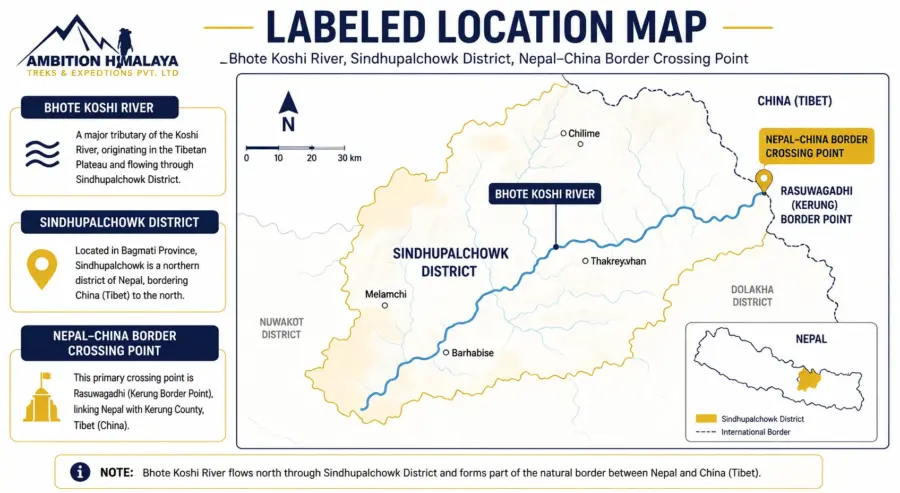
For people planning a trek or holiday in Nepal, the most important thing to understand is that the impact is concentrated in specific areas. Nepal as a whole remains open to international visitors, while authorities continue rescue, recovery, infrastructure assessment, and safety monitoring in the affected regions.

At Ambition Himalaya, we believe travelers should have clear and responsible information before making decisions about their journey. This guide explains what happened, which areas were affected, what travelers should know, and how to plan a Nepal trip safely.

What Happened in the Bhote Koshi River Area

What Happened in the Bhote Koshi River Area?

A severe flash flood struck the Bhote Koshi River area of Nepal on August 26, 2026. The flooding caused extensive damage across parts of the affected region, including houses, roads, bridges, hydropower infrastructure and other important facilities.

The sudden rise in water created extremely dangerous conditions for communities located close to the river system. Rescue teams, security personnel, local authorities and emergency services were mobilized to assist people in affected areas.

The exact scientific cause of the event is still being assessed. Initial reports have pointed toward a possible glacier- or slope-related event in the Himalayan region, rather than a conventional rainfall-driven flood.

Because the situation developed rapidly, information and casualty figures have changed as rescue teams have reached areas that were initially difficult to access.

How Serious Was the Flood

How Serious Was the Flood?

The disaster has resulted in a major humanitarian emergency in the affected river corridor.

According to the Government of Nepal’s Ministry of Foreign Affairs update of August 28, 538 bodies had been recovered from the river areas, while many people were still missing. The government also reported extensive damage to infrastructure and continued search-and-rescue operations.

The authorities have emphasized that the situation is being continuously assessed and that information may change as recovery operations progress.

For travelers, this is an important reminder that Himalayan conditions can change quickly, particularly during the monsoon season and in areas close to major rivers and steep mountain terrain.

Which Areas Were Most Affected

Which Areas Were Most Affected?

The most serious impact has been reported around the Bhote Koshi River corridor and parts of Rasuwa, near Nepal’s northern border.

Infrastructure damage in the affected area has included:

  • Roads and highway sections
  • Bridges and river crossings
  • Houses and local settlements
  • Hydropower infrastructure
  • Border and transport facilities
  • Other essential community infrastructure

Some locations remain difficult to reach because roads and bridges were damaged.

Travelers who are planning to visit Rasuwa, Langtang or other destinations connected to the affected corridor should therefore check the latest local conditions before departure and work with an experienced local trekking company.

Is Nepal Still Open for Tourists

Is Nepal Still Open for Tourists?

Yes. Nepal remains open to international travelers.

The flood has affected specific areas rather than the entire country. Nepal’s Ministry of Foreign Affairs stated in its August 28 update that Nepal remained open for international travelers and tourists, while rescue and relief operations continued in the affected region.

This distinction is important.

Nepal is a large country with many independent trekking and tourism regions. A natural disaster affecting one river corridor does not automatically mean that every trekking destination in Nepal is closed.

However, travelers should always check the latest route conditions before starting a trek, particularly during the monsoon period.

Are Popular Treks Such as Everest Base Camp Affected?

The Bhote Koshi flood should not be interpreted as a nationwide closure of Nepal’s trekking routes.

Popular destinations such as Everest, Annapurna and other major trekking regions are geographically separate from the primary flood-affected corridor.

However, conditions can change quickly in the Himalayas. Road access, domestic flights, bridges, trails and weather conditions should always be checked shortly before departure.

For trekkers planning an Everest Base Camp Trek, Annapurna Trek, Manaslu Trek or another Himalayan journey, the safest approach is to confirm the current route condition with a registered local operator before travelling.

What About Langtang Trek?

Langtang requires particular attention because parts of the region are connected to the wider Rasuwa area.

This does not automatically mean that the Langtang Valley Trek is closed. Instead, travelers should check the condition of the specific access road, bridges and trekking route at the time of travel.

A responsible trekking operator should verify current conditions before confirming transportation and itinerary arrangements.

At Ambition Himalaya, we recommend that travelers planning Langtang or nearby routes contact us before departure so that the latest available information can be reviewed and the itinerary adjusted if necessary.

Why Can Floods Happen So Suddenly in the Himalayas?

The Himalayas are an extremely dynamic mountain environment.

High-altitude glaciers, steep slopes, unstable terrain, rivers and rapidly changing weather can combine to create sudden hazards. One of these hazards is a Glacial Lake Outburst Flood (GLOF).

A GLOF can occur when water stored behind a natural glacier- or moraine-dammed lake is suddenly released. A large volume of water and debris can then travel rapidly downstream through narrow mountain valleys.

However, it is important not to describe every Himalayan flood as a GLOF before scientific investigations are complete.

In the case of the August 2026 Bhote Koshi event, authorities and scientists have been investigating the precise trigger.

nepal flood

What Is the Government Doing?

Nepal’s government has mobilized multiple agencies for the emergency response.

The response includes:

Search and Rescue

Nepal’s security forces and emergency teams have been involved in searching affected areas and assisting people who are stranded or displaced.

Evacuation and Emergency Assistance

People in vulnerable locations have been evacuated where necessary, with emergency medical and humanitarian assistance being provided.

Infrastructure Assessment

Authorities are assessing damaged roads, bridges, hydropower facilities and other infrastructure needed to restore access.

Monitoring of River Systems

River conditions and downstream flood risks are being monitored because secondary hazards can occur after major flooding.

Assistance for Foreign Nationals

Nepal’s Ministry of Foreign Affairs has established an emergency response mechanism to assist foreign nationals affected by the disaster and to coordinate information with diplomatic missions.

Emergency Contact for Foreign Nationals

The Government of Nepal has established an Emergency Response Team for foreign nationals affected by the Bhote Koshi flood.

For urgent assistance concerning affected or missing foreign nationals:

Emergency Hotline / WhatsApp:
+977-9744441227
+977-9744441228

Available: 7:00 AM – 10:00 PM Nepal Time

Email:
[email protected]

The Ministry has also advised families and members of the public to rely on official information and avoid spreading unverified reports on social media.

Should You Cancel Your Nepal Trip?

Not necessarily.

The right decision depends on where you are travelling, when you are travelling and which route you will use.

If your itinerary is completely outside the affected region, the flood does not automatically mean that your Nepal holiday should be cancelled.

If your trip includes Rasuwa, Langtang or routes that depend on infrastructure in the affected corridor, your itinerary may require additional checking or modification.

Before travelling, consider:

  • Current road conditions
  • Trail and bridge status
  • Weather forecasts
  • Local authority notices
  • Domestic flight conditions
  • Trekking permits and access requirements
  • Advice from your local trekking operator

Avoid making decisions based solely on social media posts or old news articles.

What Should Trekkers Do Before Starting Their Journey?

A few simple precautions can make a significant difference.

1. Check the Latest Information

Conditions in the mountains can change quickly. Check current information shortly before departure.

2. Use a Registered Local Trekking Company

A local operator can monitor route conditions and communicate with guides, transport providers and local authorities.

3. Keep Your Itinerary Flexible

During periods of unstable weather or infrastructure disruption, a flexible itinerary can be much safer than a rigid schedule.

4. Take Travel Insurance

Travel insurance should provide appropriate coverage for trekking and emergency situations at the altitude and destination you are visiting.

5. Follow Your Guide’s Advice

Your guide is often the person with the most up-to-date information about trail conditions, weather and local risks.

6. Avoid Restricted Areas

Never attempt to cross damaged bridges, blocked roads or restricted sections simply because they appear passable.

Nepal Remains a Himalayan Destination Worth Exploring

Natural disasters are a serious part of life in mountain regions, but they should not define an entire country.

Nepal continues to welcome travelers who want to experience its mountains, culture, villages, wildlife and diverse landscapes. From the Everest region and Annapurna to cultural journeys around Kathmandu and wildlife experiences in the Terai, the country offers destinations far beyond the area affected by the Bhote Koshi disaster.

The key is responsible travel.

Choose the right route, check conditions before departure, listen to local advice and allow your trekking company to make adjustments when conditions require them.

Travel Nepal With Local Experience

At Ambition Himalaya Treks & Expeditions, we understand that planning a Himalayan journey requires more than simply booking a package.

Our team works with experienced local guides and support staff and provides trekking, tours, helicopter experiences, climbing and customized Himalayan adventures across Nepal and other Himalayan destinations.

We have been operating since 2009 and focus on creating well-organized journeys with experienced local teams, transparent arrangements and ongoing support throughout the trip.

If you are planning to visit Nepal in the coming weeks or months and are unsure whether your chosen route is operating normally, contact our team before making your final arrangements.

We can help you review your itinerary and, where necessary, consider an alternative route or destination.

Frequently Asked Questions

Is Nepal safe to visit after the 2026 flood?

Nepal remains open to international travelers. However, conditions vary by region, and travelers should check the latest information before visiting areas affected by the flood.

Is Everest Base Camp Trek open?

The Bhote Koshi flood does not mean that the entire Everest region is closed. Travelers should still confirm current transportation, weather and route conditions before departure.

Is Langtang Trek affected?

The Langtang region requires additional attention because of its proximity and access connections to Rasuwa. Check the latest local route and road conditions before travelling.

Was the flood caused by a glacial lake outburst?

A glacier- or slope-related event has been investigated as a possible trigger. The exact scientific cause should be confirmed through official assessments rather than assumed from preliminary reports.

Can foreigners get emergency assistance?

Yes. Nepal’s Ministry of Foreign Affairs has established an Emergency Response Team for foreign nationals affected by the disaster. The official emergency numbers are +977-9744441227 and +977-9744441228.

Should I book my Nepal trek now?

You can plan your trip, but if your itinerary passes through an affected or potentially disrupted area, confirm current route conditions with a trusted local operator before finalizing your travel arrangements.

The August 2026 Bhote Koshi flood has been a tragic event for Nepal, particularly for communities and travelers caught in the affected areas.

At the same time, it is important to understand the situation accurately. A serious disaster in one part of Nepal does not mean the entire country is closed or unsafe for travel.

For anyone planning a Himalayan adventure, the best approach is informed and responsible travel: stay updated, choose your route carefully, follow local guidance and travel with an experienced team.

Nepal is still waiting to welcome you to the Himalayas.

Information in this article is based on official Government of Nepal updates available at the time of publication. Because rescue operations and route conditions can change, travelers should verify the latest information before departure.

Manaslu Circuit Trek – 16 Days: A Journey Through Nepal’s Quiet Himalayan Wilderness

Manaslu Circuit Trek There are some Himalayan journeys where the mountains are the main attraction, and then there are journeys where the entire trail becomes part of the experience. The Manaslu Circuit Trek belongs to the second category.
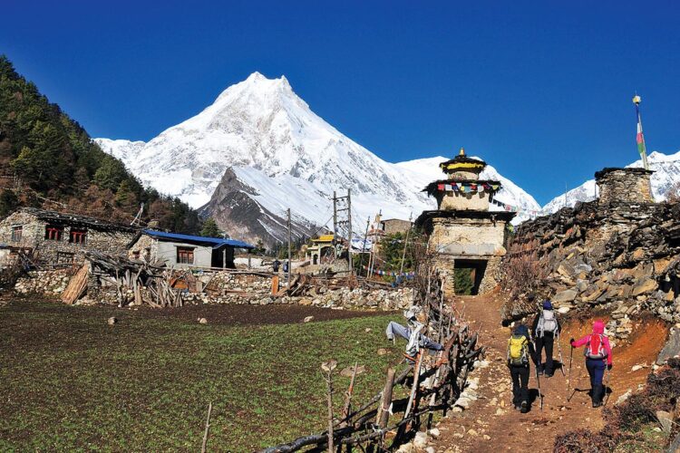
Over 16 days, the route moves from the busy streets of Kathmandu into increasingly remote valleys, following the Budhi Gandaki River through forests, waterfalls, traditional villages, Buddhist settlements and high mountain terrain before reaching the dramatic Larkya La Pass at 5,106 metres. The landscape changes almost every day, and so does the character of the trek.

For travellers who want something more intimate than Nepal’s busiest trekking routes, the Manaslu Circuit offers a compelling combination of mountain scenery, local culture and genuine Himalayan adventure. Mount Manaslu itself rises to 8,163 metres, making it the eighth-highest mountain in the world, and the circuit brings trekkers remarkably close to its surrounding peaks and valleys.

The 16-day itinerary offered by Ambition Himalaya is designed to combine the major highlights of the circuit with a sensible acclimatization day in Samagaon. The trip is available as either a private journey or a group departure, with group pricing becoming more attractive as the number of travellers increases.

Why the Manaslu Circuit Feels Different

Why the Manaslu Circuit Feels Different

The first thing many trekkers notice about Manaslu is how quickly the environment changes.

The journey does not begin among snow-covered peaks. It starts in Kathmandu and then heads towards Machha Khola, where the trail begins following the Budhi Gandaki River. From there, the valley gradually becomes narrower and more dramatic.

Villages such as Jagat, Deng, Namrung and Lho introduce trekkers to the everyday life of the mountain communities. Higher up, the architecture, landscape and atmosphere begin to show stronger Tibetan Buddhist influences. By the time the trail reaches Samagaon and Samdo, the feeling is completely different from the Nepal travellers experience in the lower valleys.

That gradual transition is one of the strongest aspects of the circuit. Instead of being surrounded by high mountains from the first morning, trekkers watch the Himalayas slowly become part of their everyday view.

The Nepal Tourism Board describes the Manaslu Conservation Area as a trekking destination where ancient trails, traditional culture and Himalayan scenery remain closely connected. The conservation area is also home to a wide range of wildlife and vegetation, including species such as snow leopard, musk deer and Himalayan tahr.

A 16-Day Route That Builds Naturally

A 16-Day Route That Builds Naturally

One reason the 16-day itinerary works well is the way the altitude increases gradually before the highest point of the trek.

Day 1 – Arrival in Kathmandu

The journey begins in Kathmandu at approximately 1,300 metres. After airport arrival, travellers are transferred to their hotel, generally giving them time to rest after the flight.

The evening can be kept relaxed. A walk around Thamel, a Nepali dinner or simply preparing for the days ahead is enough.

Day 2 – Kathmandu: Preparation and Free Day

The second day provides time to organize trekking equipment, meet the trekking team and make sure everything is ready before leaving Kathmandu.

It is also a useful opportunity to explore a little of the city. Travellers who have not previously visited Kathmandu can use the day to see some of its historic surroundings before beginning the trek.

Day 3 – Kathmandu to Machha Khola

The road journey towards Machha Khola marks the real beginning of the adventure.

The route passes through Arughat before reaching the Budhi Gandaki River and eventually Machha Khola at around 930 metres. It is a long driving day, but the scenery becomes increasingly rural as Kathmandu disappears behind you.

From this point onward, the character of the journey changes from road travel to trekking.

Day 4 – Machha Khola to Jagat

The trail follows the Budhi Gandaki River through forests and settlements.

The route passes Khorlabesi and the Tatopani area before continuing towards Jagat. Along the way, trekkers encounter suspension bridges, changing vegetation and the sound of the river cutting through the valley.

Jagat is an important settlement on the Manaslu trail and provides the first real sense that the trek is moving deeper into the mountains.

Day 5 – Jagat to Deng

The landscape becomes more rugged as the trail continues north.

After passing Philim, the route moves through forests, waterfalls and terraced agricultural areas. The trail eventually reaches Deng, where the surroundings begin to feel noticeably more alpine.

This is also where the influence of the local mountain communities becomes increasingly visible.

Day 6 – Deng to Namrung

The trek continues through Prok and other traditional settlements before reaching Namrung at approximately 2,900 metres.

The mountain scenery becomes more impressive here, with views opening towards peaks including Manaslu, Ganesh Himal and Annapurna II.

The change in elevation is noticeable, but the relatively gradual progression makes this section an important part of the acclimatization process.

Day 7 – Namrung to Lho Gham

This is a shorter trekking day compared with some of the later sections.

The trail climbs through pine forest and mountain settlements towards Lho Gham at approximately 3,180 metres. Lho is particularly memorable for its mountain views and Buddhist monastery.

From here, Mount Manaslu begins to feel much closer.

Day 8 – Lho Gham to Samagaon

The trail continues towards one of the most important villages on the circuit: Samagaon.

At around 3,550 metres, Samagaon sits in a spectacular mountain setting. The surrounding landscape includes views towards Manaslu, Himalchuli and other major peaks, while nearby Buddhist monasteries provide a glimpse into the spiritual traditions of the region.

The route also passes through settlements such as Shyala and Sama before reaching Samagaon.

Day 9 – Acclimatization in Samagaon

This is one of the most important days of the itinerary.

Rather than continuing directly to higher elevations, the schedule allows trekkers to spend a full day in Samagaon. The day can be used to explore the village and surrounding area, with options including a hike towards Pung Yen Monastery.

A proper acclimatization day is particularly valuable because the route becomes considerably higher after Samagaon.

Some trekkers may also be interested in a longer excursion towards Manaslu Base Camp, depending on conditions and the group’s schedule.

Day 10 – Samagaon to Samdo

The landscape becomes more open and increasingly barren as the trail climbs towards Samdo at approximately 3,690 metres.

The route follows the Budhi Gandaki and passes through high-altitude grazing areas. The surrounding terrain is very different from the green forests encountered during the first half of the trek.

Samdo is also close to the Tibetan border region and has a distinctive high-Himalayan atmosphere.

Day 11 – Samdo to Dharamsala

The distance is relatively short, but the altitude makes this section more demanding.

The trail passes through Larkya Bazaar and continues towards Dharamsala at around 4,450 metres. The surrounding landscape becomes increasingly stark, with glaciers, rocky slopes and high mountain terrain dominating the scenery.

Dharamsala is the final overnight stop before the biggest challenge of the circuit.

Day 12 – Crossing Larkya La Pass

This is the day many trekkers remember long after returning home.

The trail leaves Dharamsala early and climbs towards Larkya La Pass at 5,106 metres. It is the highest point of Ambition Himalaya’s 16-day Manaslu Circuit itinerary and the most physically demanding section of the trek.

The climb takes trekkers across high-altitude terrain before reaching the pass, where the surrounding Himalayan panorama opens dramatically.

After crossing Larkya La, the route descends towards Bhimtang at approximately 3,595 metres.

It is a long day, but it is also the defining moment of the entire circuit.

Day 13 – Bhimtang to Tilje

The landscape begins to transform again.

After the high-altitude environment around Larkya La, the trail gradually descends through forests and greener terrain. Rhododendron forests become more prominent, and the route passes grazing areas and traditional settlements before reaching Tilje.

The contrast between the previous day’s high pass and the lower, greener landscape is striking.

Day 14 – Tilje to Chyamje

The journey continues towards the lower valleys, passing through Dharapani and joining areas connected with the Annapurna region.

The trail follows the Marsyangdi River system and gradually loses altitude. Forests, villages and cultivated land replace the barren high-altitude landscape.

By the time trekkers reach Chyamje, the biggest mountain-pass challenge is behind them.

Day 15 – Chyamje to Besisahar and Kathmandu

The final road journey begins from Chyamje towards Besisahar and then Kathmandu.

The drive passes waterfalls, rivers and mountain villages before gradually returning to the more developed areas of Nepal.

After days in remote Himalayan valleys, arriving back in Kathmandu can feel surprisingly different.

Day 16 – Departure from Kathmandu

The final morning is reserved for departure.

Travellers can return home or choose to extend their Nepal stay with another destination, cultural experience or short adventure.

What Makes Larkya La Pass So Special

What Makes Larkya La Pass So Special?

Larkya La is not simply another viewpoint on the itinerary. It represents the transition between two very different sides of the Manaslu region.

The climb begins in the cold, dry landscape around Dharamsala and eventually reaches the pass at 5,106 metres. On a clear day, the surrounding mountain panorama is enormous, making the difficult climb feel worthwhile.

The important thing is not to treat Larkya La as a race.

The altitude, weather and terrain can change quickly, and the best approach is to maintain a steady pace, follow the guide’s advice and allow enough time for the crossing.

The 16-day Ambition Himalaya itinerary specifically places Dharamsala immediately before the pass and Bhimtang immediately after it, allowing the highest section of the trek to remain a dedicated part of the journey rather than being rushed into a longer sequence of unnecessary stops.

Culture Along the Manaslu Trail

The Manaslu Circuit is not only about mountains.

One of the most rewarding parts of the trek is seeing how life changes from village to village.

Lower sections of the trail feature Gurung communities, terraced fields, forests and traditional houses. Higher up, Buddhist monasteries, prayer flags, mani walls and Tibetan-influenced settlements become more common.

Samagaon and Samdo are particularly important cultural stops. The journey gives travellers the opportunity to experience mountain communities where tourism exists alongside traditional ways of life.

This is one reason having a knowledgeable local trekking team can add considerably to the experience. A mountain guide is not simply someone who walks ahead and points out the trail. A good guide can explain the meaning behind monasteries, local customs, village traditions and the changing landscape.

Permits and Responsible Trekking

The Manaslu region includes restricted areas, so travellers should make sure their permits and trekking arrangements are properly organized before starting the journey.

The Nepal Tourism Board states that the Manaslu Circuit is among the trekking routes where a licensed trekking guide and agency-issued TIMS card are required under the revised TIMS provisions.

The Nepal Tourism Board also lists the Gorkha Manaslu area as a restricted trekking area and provides the applicable restricted-area permit information.

For the most current permit rules, travellers should always check the official government sources before travelling because regulations and fees can change.

The Department of Immigration, Nepal currently publishes the trekking route and permit information for the Gorkha Manaslu area, including seasonal restricted-area permit rates.

When Is the Best Time for the Manaslu Circuit?

The two most popular trekking periods are generally spring and autumn.

Spring brings clearer mountain views, blooming rhododendrons and relatively stable trekking conditions. Autumn is popular for its clear skies, crisp mountain visibility and comfortable trekking conditions.

The Nepal Tourism Board lists March to May and September to November as the best seasons for the Manaslu Conservation Area.

Winter is much colder at high elevations, particularly around Dharamsala and Larkya La, while the monsoon season can bring rain, clouds and difficult trail conditions in lower sections.

That does not mean the mountains are completely off-limits outside the popular seasons, but the decision should be based on current weather, trail conditions and professional local advice.

How Much Does the Manaslu Circuit Trek Cost?

For travellers planning a private group, the group size can make a noticeable difference to the per-person price.

Ambition Himalaya currently lists the following group-discount structure for its 16-day Manaslu Circuit Trek:

Group Size Price Per Person
1 person US$1,450
2 people US$1,150
3–5 people US$1,100
6–9 people US$1,050
10–15 people US$1,000
16+ people US$950

The package page currently lists the trip from US$950, with group or private travel available. It also lists hotel, lodge and homestay accommodation options, trekking and hiking activities, and meals as part of the package information.

For friends, couples, families or larger private groups, this pricing structure can make organizing the trek together particularly attractive.

What Kind of Traveller Is This Trek For?

The Manaslu Circuit is best suited to people who enjoy walking for several consecutive days and are comfortable with changing conditions.

It is officially presented as a strenuous trek, and the itinerary reaches 5,106 metres.

You do not need to be an elite mountaineer, but preparation matters.

Regular walking, uphill training, cardiovascular exercise and some longer hikes before arriving in Nepal can make the experience much more enjoyable.

The most important quality on this trek is often patience. The mountains decide the pace. Weather can change, the trail can become demanding and high altitude requires respect.

A More Meaningful Way to Experience Manaslu

There is a temptation with Himalayan trekking to focus only on reaching the highest point.

But the Manaslu Circuit is better understood as a journey of gradual change.

You begin in Kathmandu.

Then there are roads, rivers and subtropical landscapes.

Then forests.

Then Gurung villages.

Then Buddhist monasteries and high mountain settlements.

Then the stark landscape around Samdo and Dharamsala.

Then Larkya La.

And finally, the descent into greener valleys.

That progression is what gives the Manaslu Circuit its personality.

It is not simply a trek to a viewpoint. It is a journey through several different Himalayan environments, connected by one long trail around an extraordinary mountain.

Planning the Manaslu Circuit with Ambition Himalaya

For travellers looking for a structured 16-day journey, Ambition Himalaya offers the Manaslu Circuit as both a group-joining and private trip. The itinerary includes the important acclimatization stop at Samagaon and the Larkya La crossing before descending towards Bhimtang and returning to Kathmandu.

The current itinerary and booking information can be checked directly here:

Manaslu Circuit Trek – 16 Days:
View the Manaslu Circuit Trek itinerary on Ambition Himalaya

Before booking, travellers should confirm the latest departure dates, inclusions, transportation arrangements, permit requirements and weather-related policies directly with the trekking company.

Official Nepal Government & Tourism Resources

For travellers researching the Manaslu Circuit independently, these official resources are useful:

Before You Set Out for Manaslu

The Manaslu Circuit is the kind of trek that stays with you in small details — the first morning beside the Budhi Gandaki, the stone villages above the valley, the prayer flags around Samagaon, the cold morning at Dharamsala, and finally the long climb towards Larkya La.

The 16-day route brings all of these experiences together without making the journey feel like it is only about reaching a high point. There are quiet village evenings, changing landscapes, mountain culture and long walking days, followed by the very different scenery of Bhimtang and the lower valleys.

If you are planning the Manaslu Circuit Trek – 16 Days and want to know more about the itinerary, group discounts, available departures, permits, transportation or what to expect on the trail, the Ambition Himalaya team can help you plan the journey according to your travel dates and group size.

For Manaslu Circuit Trek bookings and enquiries:

WhatsApp / Phone: +977 9851148898
Email: [email protected]

Ambition Himalaya
Your Manaslu journey starts with the right plan.

↑