When Is the Best Time to Visit Bhutan? Weather, Festivals and Tips

Introduction

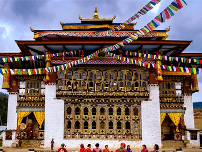
Bhutan is a small Himalayan kingdom where time slows down, monasteries hang on cliffs, and nature blossoms at all times of the year. It is a mystical land that attracts travelers who want peace, spirituality, stunning scenery, and ancient culture.

The best time to visit Bhutan is throughout the year, depending on what you would like to see and do. Some travelers prefer sunny days and hiking trips, while others celebrate colorful cultures and a tranquil escape in nature.

When to go is a decision that will significantly impact your experience, be it mountain-chasing or the Bhutanese culture. All seasons have their own climate patterns, celebrations, and landscapes, which depict the country with different colors.

This blog provides an overview of the weather conditions in Bhutan throughout the year, its festivals, and professional travel advice. It assists you in planning a trip depending on your choice, to make your Himalayan trip memorable and rewarding.

Overview: Bhutan’s Climate and Travel Seasons

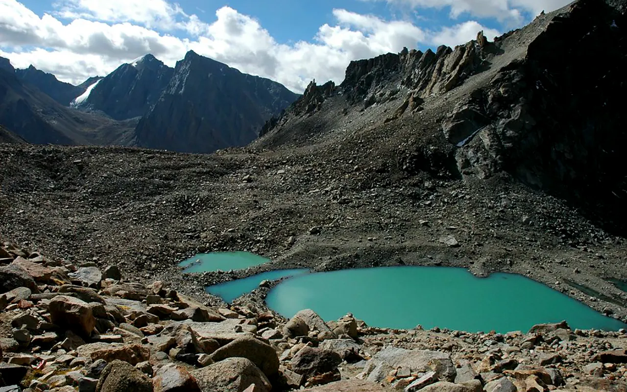
The elevation of Bhutan is very uneven, as it has a lower altitude of 200 meters in the southwest plains and a higher altitude of 7,500 meters in the Himalayas. This large diversity provides a wide range of climatic conditions from subtropical lowlands to temperate mid-hills to alpine highlands.

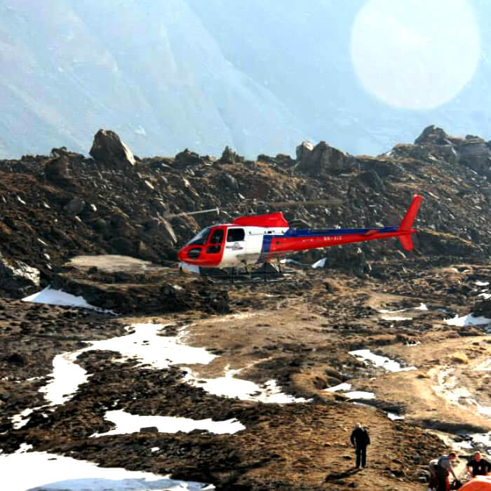
Bhutan has four major seasons that provide different experiences as far as tourism is concerned. The period between March and May transforms the valley into a vibrant bloom with dazzling rhododendrons and blue skies, which can be enjoyed by trekkers and nature lovers.

The summer or monsoon is characterized by green scenery and intense rainfall, particularly along the southern parts of Bhutan. Tourist numbers drop, making it a quieter time to travel because the wet weather may complicate the plans.

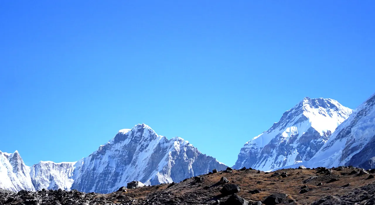
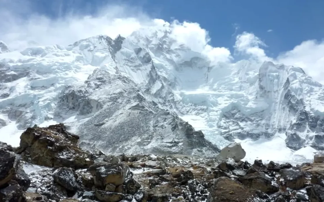
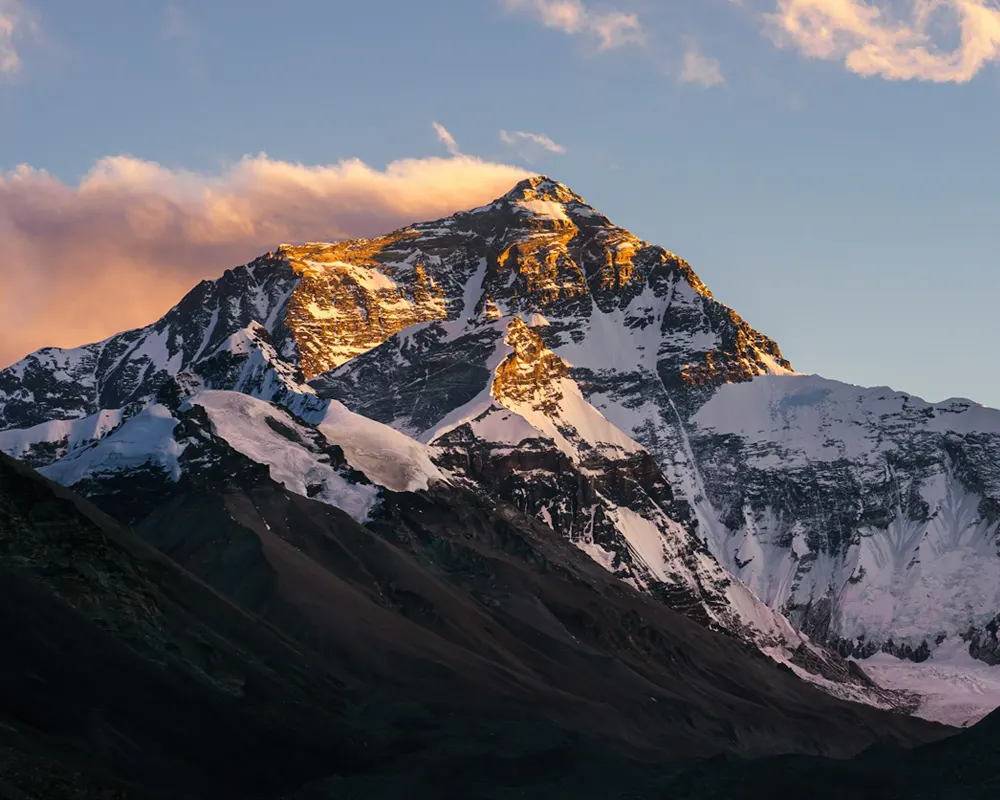
The months of September to November are the most advisable months to view the mountains clearly. December to February is snowy and cold in the mornings.

Ura Yakchoe

Spring (March to May)

Spring in Bhutan (March to May) is mild with temperatures between 15 °C and 25 °C in the valleys. This season is filled with the blooming of rhododendrons and wildflowers, painting the country with beautiful and colorful scenery.

Spring is an ideal season for nature walks, photography, and cultural tours. The pleasant weather and blooming flowers make it a famous season, the varied natural beauty of Bhutan and discovering the traditional village life at a leisurely pace.

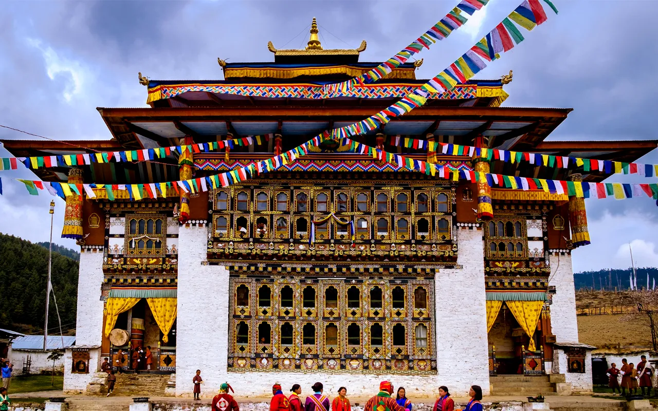
The highlight in the spring season is Paro Tsechu, held in March or April, an event described as colorful and cultural displays of mask dances of mystic spirits. Another important festival that takes place is Ura Yakchoe in May, celebrated in Bumthang with sacred rituals.

The season brings in clear mountain views and colorful context, also very occurring, however, not overcrowded in every place. Springtime travel offers a sweet spot between the beauty of Mother Nature and the richness of the cultural fabric in Bhutan, with none of the tourist congestion associated with peak.

Traveling in spring offers a perfect blend of perfect conditions, attractive landscapes, and rich cultural experiences. It remains a famous season and time period when lots of travelers desire to experience the natural and spiritual beauty of the Himalayan kingdom.

Summer / Monsoon (June to August)

The summer season includes warm days and lots of rain in Bhutan, particularly in the southern valleys. The landscapes are transformed into bright green vegetation, which makes the scenery appear serene and refreshing.

This is the season that is favorable to travelers who want discounted hotel rates and solitude. The silence of the season enables one to explore peacefully and to be able to enjoy Bhutan without the flock of tourists that is common in the other seasons.

Summer festivals such as Kurjey Tshechu in June are when sacred mask dances are performed, and Haa Summer Festival in July, when the local culture is celebrated with sports and traditional rituals. The two provide interesting insights into cultures.

Tourists are advised to be cautious because of the poor mountain visibility and occasional roadblocks, which may arise as a result of heavy rainfall. The weather is unpredictable, and travel plans may be disrupted in remote high-altitude locations; therefore, there should be flexibility and readiness.

Nevertheless, summer is ideal for travelers seeking solitude, dramatic skies, and lush scenery. It is a peaceful period to enjoy the natural beauty of Bhutan in peace, without the commotion of people.

Autumn (September to November)

In Bhutan, autumn is characterized by clear skies, warm temperatures of about 20°C during the day, and cool nights. This season offers ideal conditions for outdoor adventures and cultural exploration.

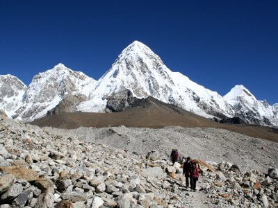
The environment is optimal for trekking, cultural tours, scenic mountain flights, and photography. The abundance of natural, stunning landscapes and the presence of untouched cultural heritage contribute to the representation of the beautiful Bhutan, which boasts good weather and the possibility of seeing the stunning views.

Major autumnal festivals are Thimphu Tsechu, Wangdue Phodrang Tsechu, or Jambay Lhakhang Drup. The colorful mask dances and joyful celebrations are a part of these events, further providing the traveler with good cultural experiences and a lifetime of memories.

It is also the colorful season of autumn, during which golden fields and fertile foliage can be seen in addition to the already marvelous view of the country. The highest points of the Himalayas are as clear as ever and attract both photographers and nature lovers.

The season is well considered as the best season to visit Bhutan, which matches the best weather and rich cultural celebrations, making every trip deeply rooted and to be remembered.

Winter (December to February)

The winter months (December to February) in Bhutan is cold in the morning, and the temperatures range between 0°C and 10°C. Clear skies dominate in the early morning with snow cover at high altitudes, making the scenery a magical and serene one.

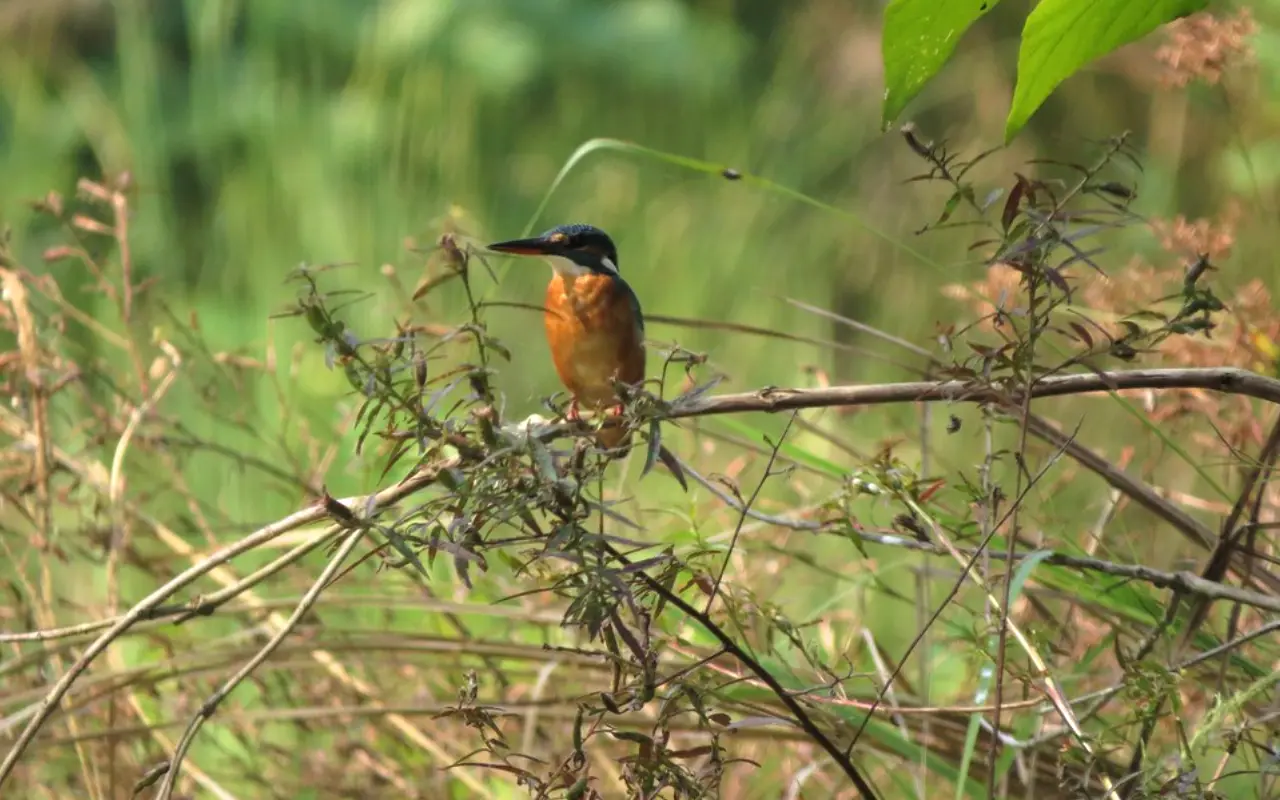
Culture sightseeing, bird watching, photography, and quiet meditation retreats are best carried out during this season. The tranquil surroundings enable the tourists to have a strong association with the religious culture as well as the beauty of Bhutan.

Some important festivals in winter are Punakha Drubchen and Trongsa Tsechu. Bhutan boasts a rich cultural background with dances done in masks and other historical re-enactments in these festivals.

In winter, the days remain sunny despite cold mornings; there are fewer visitors here, and the hotel and travel services are cheap. There is a more intimate feeling of the place, and most cultural attractions are accessible only within the quieter setting.

Winter travel offers tranquility and meaningful interaction with the locals. This season offers an authentic local experience to the off-season explorers needing some tranquility and localness without the crowd and noise in Bhutan.

Best Time to Visit Bhutan for Specific Experiences

ExperienceIdeal Time(s)Notes
Cultural FestivalsMarch – April, September – NovemberMany tsechus and local festivals are held during spring and autumn.
Trekking & HikingMarch – May, September – NovemberTrails are drier, skies clearer, and stable weather is more likely.
Photography (landscapes, sharp colours)October – November, March – AprilCrisp light, clearer skies, great mountain visibility.
Budget TravelJune – August, December – FebruaryOff-peak months see fewer tourists and more deals. But beware of monsoon disruptions (Jun–Aug).
Honeymoon & Luxury ToursMarch – May, October – NovemberPleasant weather, beautiful scenery, and comfortable travel conditions.
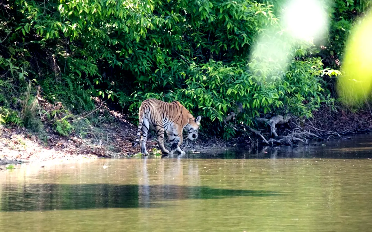
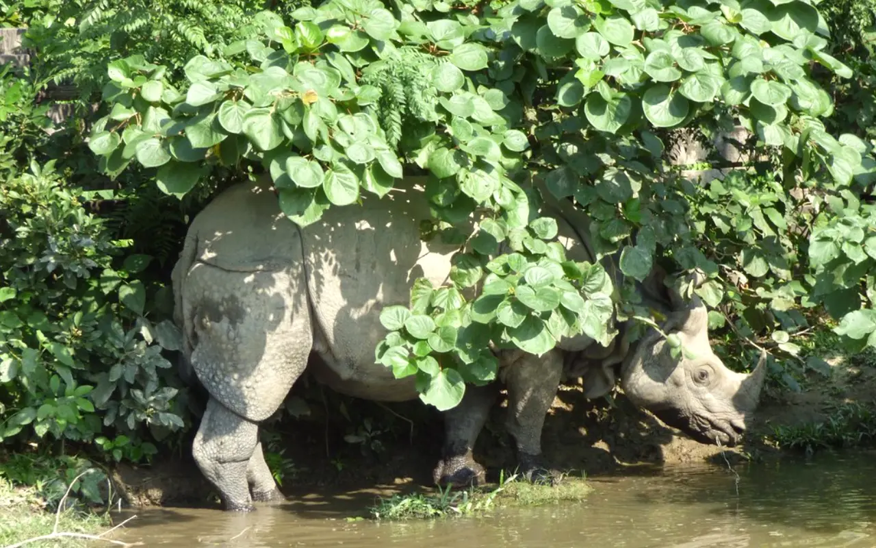
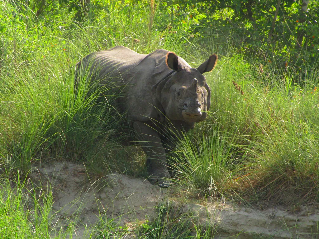
Wildlife Watching & BirdingFebruary – MaySpring is great for bird migration, blooming forests, and active wildlife.

Travel Tips for Visiting Bhutan

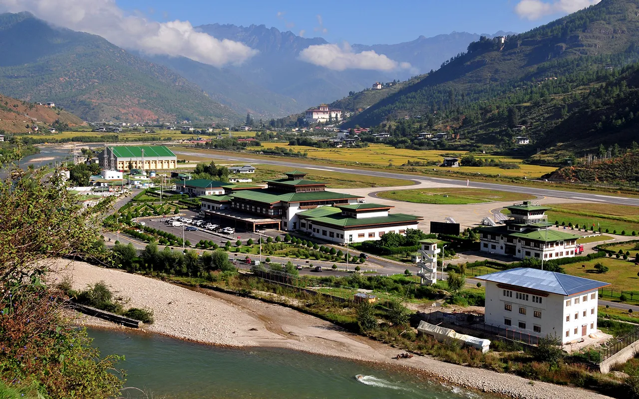
If you plan on visiting Bhutan, reserve the flights as soon as possible since Drukair and Bhutan Airlines are the only companies operating flights into Paro. Tickets are limited, especially during peak travel seasons, so you will want to be sure to secure your tickets well in advance for a seamless trip.

Visitors to Bhutan must have a visa arranged through a licensed Bhutan tour operator. You are not permitted to travel independently in Bhutan, as all tourism is regulated to ensure that sustainable tourism maintains the culture and environmental integrity of the country while also providing a safe, organized experience for visitors.

The fee for SDF that travellers are required to pay per night is USD 100.  The fee is for responsible and sustainable tourism management in the kingdom.

You should pack layers, since temperatures can fluctuate frequently. Warm layers are essential in winter at higher elevations, a rain jacket is a must in summer, while hats and sunscreen are necessary in spring and autumn as sun protection. Bring a motion-sickness medication for the winding mountain roads and ensure your health safety.

Paro Airport

Combining Bhutan with Nepal or Tibet

The multi-country tours offer some of the richest heritage, beautiful landscapes, and spiritual sites. Paro International Airport offers seamless flight connections to Nepal and India.

The most preferable season when Bhutan and the surrounding countries of Nepal or Tibet should be visited is the spring and autumn. These are the months with clear skies, cool weather, and festivals, which make for great trekking, a cultural tour, and photography opportunities in all destinations.

We can customize the itineraries based on your preferences. Our guided excursions guarantee seamless logistics and the most amazing visits so that you have the opportunity to experience the cultural richness and natural magnificence of the Himalayas in its fullness.

Conclusion

Bhutan has amazing scenery and a cultural wealth all around the year, although the best season to visit depends on one’s preferences. Choose spring for vibrant colours, autumn for clear mountain views, winter for serenity, or the monsoon for solitude.

Responsible travel means that you learn to love the natural and cultural setting of Bhutan, and you enjoy the slow, spiritual ways of Bhutan. This conscious attitude makes these meaningful experiences, and conserves the untainted practices of Bhutan for the coming generation.

Mark your tour in Bhutan with us; we schedule your trip depending on your interests in the field, be it trekking, festival tours, or cultural journeys. In any case, your Himalayan adventure is once in a lifetime.

Dolma La Pass: The Holiest and Toughest Point on the Kailash Mansarovar Yatra

Dolma La Pass is located in western Tibet (Ngari Prefecture), on the Kailash Kora Route, a perfect blend of spirits and breathtaking scenarios located at an altitude of ~5,630–5,650 m (≈18,471 ft.). This pass marks the highest point of the Kailash kora route around one of the majestic peaks that stands tall over the sky, Mount Kailash. Mount Kailash is regarded as a holy place of Buddhism and Hinduism. This place is often believed to have a spiritual importance where an individual can be reborn and cleanse their karma.

Kailash Mansarovar Yatra is not just a journey to the Himalayas; it is a journey to reconnect your soul to peace. Followers or Pilgrims from all around the world, especially from the Hindu, Buddhist, Jains, and Bon communities, consider this as one of the transformative and sacred paths where one can gain spiritual experience. Dolma La Pass lies at a high point on the kora (circumambulation) route, between Dirapuk and Zuthulpuk, one of the challenging and hardest points to reach Mount Kailash. This journey takes you through the holiest and thrilling experience.

Dolma La Pass
Dolma La Pass

What is Dolma La Pass?

Dolma La Pass is located at the highest point of Kailash Parikrama, one of the sacred perambulations of Mount Kailash. Dolma la Pass, sitting at the height of ≈5,630 m, is marked as one of the dramatic yet explicate moments that can be felt within 3 days of trek around this holy mountain Kailash.

Dolma La lies at the heart of Tibet that connecting Parikrama (Dirapuk to Dolma La) with Zuthulpuk Monastery. The Path to this pass is exhausting, the ascent of this pass is exhausting, and so it can take hours of trekking. Air becomes thin, and once you keep trekking to the top air starts to become thinner. Every step feels. Like you fighting with cold and thin air. Once you are at the top, you will find yourself surrounded by snow patches, mountains, and a bundle of prayer flags fluttering in the cold and icy wind.

Dolma La pass is not just about trekking, but it is about feeling the spiritual energy. Without crossing this pass, your Kailash Yatra is incomplete. Many of the beliefs say that the person crossing this pass is equivalent to losing their past sins.

Mount Kailash
Mount Kailash

Mythological and spiritual significance

Tibetan Buddhism Mythology and Spiritual Significance

Dolma la Pass is believed to have Spiritual and mythological importance, as this pass is named after a Tibetan Buddhist goddess, Dolma (Tara). A goddess of forgiveness and compassion. Climbers or followers believed that, while someone is attempting to climb this pass, Dolma watches them, which provides. Pilgrims’ spiritual strength, especially for those who struggle.

Hindu Mythology and Spiritual Significance

In Hindu mythology, this pass adds another layer of significance. It is believed that crossing the Dolma La pass will represent the journey from one life to the next life for many pilgrims. They believed that ascending and descending the path represents the individual’s cycle of birth and death or death and rebirth. This pass acts like a bridge between Death and rebirth.

Mount Kailash
Mount Kailash

Jain Tradition, Mythology, and Spiritual Significance

For Jains, Dolma La Pass is one of the parts of the Kailash Mansarovar Yatra. Jains revere the Kailash-Ashtapad, and Dolma la is part of wider pilgrimage circuit. They treat hardship as a foundation of discipline before crossing Dolma La Pass; they meditate, fast, and keep vows of silence and practice austerities. Despite being a difficult path, this journey symbolizes the soul’s struggle towards moksha. This extreme journey represents tapas and burning away karmas.

Bon Tradition, Mythology, and Spiritual Significance

In Bon Tradition, Dolma La Pass is crossed in the opposite direction, where the pilgrim moves counterclockwise around Mount Kailash. At the pass, Bon’s offers player flags, personal tokens, and incense to the spirits and their deities in the sake of protection and blessing. For Bon Dolma, La Pass represents death and rebirth. The climb represents the cleansing of the soul and renewing life.

Pilgrims often leave their personal belongings, offerings, and prayer flags behind. This symbolizes the token of devotion and leaving a burden behind. Therefore, this pass is not just a pass that tests your physical ability but also your spiritual belief.

Mount Kailash Tour from Nepal
Dolma La Pass is located in western Tibet (Ngari Prefecture), on the Kailash Kora Route, a perfect blend...
17 Days
Easy

Gauri Kund – The Lake of Compassion

Below the sacred Dolma La Pass, there is a holy Lake Gauri Kund, also known to be the “Lake of Compassion”. This vibrant lake holds spiritual significance in Hindu tradition as this lake is believed to the part of Goddess Parvati, also known as Gauri, where the goddess performed self-punishment.

According to many historical stories, this lake is the very spot where goddess Parvati used to take a bath, and climbers or pilgrims today take home this holy water as a blessing. Direct descent is dangerous and restricted for most pilgrims. Many pilgrims and trekkers pause to offer prayers from above.

Gauri Kund
Gauri Kund

The beauty of Gauri Kund is commendable. Shiny snow and rock make this lake breathtaking. For many, this Lake acts as a retreat from the difficult path of Dolma La Pass.

The Physical Challenge of Crossing Dolma La Pass

Dolma La Pass is the toughest crossing. The toughest part of the entire Kailash Mansarovar Yatra, which starts from Dirapuk, a place where trekkers have to face steep ascent for several hours in thin air, and at high altitude, where every step feels heavy.

This whole trek is like battling with extreme cold, unpredictable snowfall, and icy cold wind. Ascend will take you approximately 4 to 6 hours, while descending towards Zuthulpuk can take you approximately 3 to 4 hours, making your whole trek approximately 8 to 10 hours of trekking. Challenging and steep slopes require your physical stamina and mental resilience. Your determination plays a huge role here.

Aside from the difficulty, pilgrims take this day as a memorable experience. The execution while ascending and descending feels like an achievement.

Preparing for Dolma La Pass

Here are some tips mentioned to help you prepare for Dolma La Pass.

Acclimatization

You have to spend most of the days and hours at a high altitude where the air is slightly thinner. Before attempting the Parikrama plan, proper acclimatization is required to help you from burning.

Fitness Training

Attempting Dolma La Pass requires physical strength as it is the toughest part of the journey. Try doing cardiovascular activities such as cycling, swimming, and running to build stamina. Strength and stamina will help you go through the difficulty you are going to face while attempting Dolma La Pass.

Gear essentials

Here are some trekking gear essentials you will need: trekking poles to maintain your balance, proper layered clothing to help you get through harsh weather conditions, water waterproof jacket, waterproof gloves, high-altitude boots, sunglasses, a charger, a Satellite phone, and lastly energy-rich snacks. Water purifying tablets are necessary.

Mental Readiness

You have to keep yourself mentally prepared to climb this challenging path. One should have a positive, determined, and strong mentality. To keep yourself mentally positive, consider doing meditation, chanting prayers, and mantras.

Best time to cross the Dolma La Pass

The best seasons to cross the Dolma La pass are late April – June and mid-September – mid-October, when the weather conditions are comparatively suitable. During this month, snow melts, which makes it easy to pass the trials. Even the skies are clearer.

Winter, from the month of November to March, is unfavorable due to heavy snowfall, subzero temperatures, and blocked trails. Same as winter, monsoon Season from the month of July to August increases the risk level due to landslides, slippery trails, and unpredictable weather.

Don’t think the best and favorable weather doesn’t brings any risk, as the weather at Dolma La Pass can change at any minute. So, trekkers and Pilgrims should prepare accordingly.

Pilgrim & Trekkers experience

Many of the pilgrims and Trekkers feel this trek to one of an emotional and rewarding Journey. The sights of the spiritual scenario, prayer Flags, and holy places make them feel attached to their soul. Some cry in relief and some cry in happiness as they bow to the goddess Dolma before crossing Dolma La Pass.

Some of the sayings of pilgrims and trekkers are mentioned below,

“The trek to Dolma la Pass tested my faith and pushed my endurance to its limits, but the strength I drew from the prayers and mantras carried me through,” and “Crossing Dolma la Pass was an intensely emotional experience, fulfilling a lifelong dream of completing the Mount Kailash kora”.

“I thought I could not take another step, but when I saw the flags and heard the chants, something carried me forward. It was as if the mountain itself gave me strength.”

For many people, physical burden seems nothing once they have achieved their goal to pass Dolma la Pass. One this that is very necessary is that you need to be determined to get to the height.

Travel Information

Permits

Mount Kailash lies in western Tibet, so all of the pilgrims and trekkers need to obtain permits, which are basically issued by the Chinese authorities. The Yatra is organized by authorized government-approved travel agencies in Nepal and India.

Support Team

roups include medical staff, guides, porters, and yaks. Porters and Yak are there for you to carry your belongings.

Group Size

Most of the group consists of ~15 to 30 people, which ensures both safety and companionship.

Emergency Protocols

In case of any difficulties like altitude sickness, there are facilities for jeeps and horses. Oxygen supplies are often available.

Accommodation

Pilgrims can stay in the basic guesthouses and tents along the routes.

Frequently Asked Questions

How difficult is Dolma La Pass?

Dolma La Pass is the toughest part of the entire Kailash Mansarovar Yatra. This requires determination, physical stamina, and proper acclimatization.

What altitude problems may occur?

Altitude problems that may occur are altitude sickness, breathlessness, headache, fatigue, and nausea, which is basically occurred due to thin air and lack of oxygen.

Do all pilgrims attempt the full pass?

Yes, pilgrims attempt the full pass as it is one of the important parts of Parikrama; however, if the condition is worse, some of them return.

How long does it take to cross Dolma La Pass?

It will take ~ 6 to 8 hours, depending on the weather conditions and fitness.

Is Gauri Kund accessible to everyone?

Gauri Kund is not always accessible due to a steep path, which is very difficult for pilgrims, so most of the pilgrim offers prayers from above.

Can elderly pilgrims cross Dolma La safely?

Yes, elderly pilgrims can cross Dolma La Safely with proper preparation, planned acclimatization, and support of yaks and porters. Many of the elderly pilgrims have successfully crossed Dolma La.

What is the best season for the Kailash Parikrama?

Months from April to September are the best season for the Kailash Parikarma.

Conclusion

Dolma La Pass is one of the spiritually as well as physically tiring journeys. It is the toughest part of the entire Kailash Mansarovar Yatra. This yatra challenges your body but uplifts your heart and soul. Crossing Dolma La Pass is not just about reaching the highest point of the trek; it is about feeling the spiritual energy, taking blessings, and enjoying the raw beauty of the Himalayas. This journey will teach you to let go of the burden in life and regain new positive energy.
For Pilgrims crossing the Dolma La Pass is not about adventure, it is about their belief and faith. For trekkers, this journey is about the adventure of life lifetime. Dolma la pass is overall a holy destination, a destination that is believed to reconnect you with your soul. A journey that is a bridge between death and rebirth. This journey is meaningful to each and every person, whether he/she is a pilgrim or just a trekker seeking adventure.

The journey from Dolma La Pass to Kailash Mansarovar Yatra should be felt by each and every person. Are you ready to reconnect with the world?

Everest Rainbow Valley: Stories of Climbers Who Never Returned

Introduction

For every climber in the world, Everest is regarded as the peak of mountaineering. Climbing the mountain to its peak signifies the conquest of the tallest mountain on Earth, which motivates millions of adventurers to overcome severe heights, climatic conditions, and physical abilities.

There exists an ugly reality beyond the beautiful landscape of Everest. The so-called Rainbow Valley (after the colorful climbing gear abandoned therein) is a cold spot where we find frozen corpses. It is a ghostly meeting of breathtaking scenery and crushing loss on the mountain.

Rainbow Valley reminds us of nature’s power and Everest’s dangers. So many of the climbers who overstepped it never came back. Their frozen relics act as living witnesses with tales of heroism, sacrifice, and the ultimate cost that some may pay in their quest to achieve their mountaineering goals.

This blog discusses the dark story behind the Rainbow Valley frozen bodies. Through these tales, we honor the dead and catch a glimpse of the darker face of Everest–where the dream of summit attainment all too frequently results in loss of life itself.

What is Everest Rainbow Valley?

Rainbow Valley is on the north slope of Everest. The name gives an impression of a green nature at first sight, but the truth is rather uglier. Rainbow Valley is over 8000 meters in altitude, and is the notorious Death Zone.

It has become the final burial place of dozens of climbers who did not return from the top or lived long enough to do so. It is referred to as Rainbow Valley due to the bright colored mountaineering suits, jackets, sleeping bags, and climbing gear littering the snow behind.

On the contrasting white backdrop of the Himalayan mountains, the reds, blues, yellows, and greens pretend to be a nightmare canvas. Yet these are not colors on flags or ornaments. They are among those frozen climbers who did not find their way home and whose bodies were still in their condition, frozen where they last fell.

Rainbow Valley is not covered by avalanches or ice like the other regions of the mountain. The air is thin, the slope is steep, and the topography is treacherous. There are practically no attempts to retrieve fallen climbers at these heights. This has made Rainbow Valley a landmark and a warning: the peak is almost in reach, and so is death.

This duality of Everest Rainbow Valley is what makes it haunting. On the one hand, climbers who go through will see one of the most stunning sights on Earth. On the other hand, they have to pay the price of their ambition. It is a beautiful location trapped in tragedy, a lesson that Everest must be respected, at times, and it will take away more than it gives.

The Death Zone and Its Dangers

Once past 8,000 meters, Everest reaches what is known by the mountaineers as the Death Zone. The name is no exaggeration. An increase in elevation also reduces the oxygen level to only a third of what is required by humans at sea level.

The human body starts to deteriorate very fast without the use of supplemental oxygen. The brain cannot regenerate cells, some processes in the body find it hard to operate, and each move becomes a marathon.

The dangers here are many. One of the most widespread dangers is exhaustion, one of the most common killers. Even the most powerful athletes can stagger just several hundred meters to safety after several days of climbing in thin air.

High-altitude cerebral edema (HACE) and high-altitude pulmonary edema (HAPE) are two forms of altitude sickness that can strike suddenly, making you feel confused, with fluid in your lungs, or with deadly swelling in your brain. Hypothermia and frostbite make fingers and toes black in hours.

Another risk that is always present is falls. There is not much room to make a mistake in the icy slopes, changing weather, and sheer cliffs of Everest. One slip and a climber will go crashing down into complete oblivion. Avalanches, hidden crevasses, and blizzards add to the risks. These dangers explain why Everest has claimed so many lives.

Bodies can hardly be recovered in the Death Zone. At those altitudes, the helicopters cannot fly safely. Already in a lowered oxygen state, rescue teams put their own lives in jeopardy when they attempt to drag up the load of an extra human. In the vast majority of cases, no one carries dead climbers across the Death Zone. The mountain serves as their cemetery.

Rainbow Valley acts as a concentrated reminder of this ugly truth. Every climber lying there was able to endure the full force of the Death Zone. In their stories, we are reminded that Everest is not conquered but survived.

Journey to Everest Base Camp across Khumbu Glacier

Famous Stories of Climbers Who Rest in Everest Rainbow Valley

Everest Rainbow Valley is more than a name; it is a group of human stories. All of the bodies illustrate an example of a climber who, at one point, had a dream of being on the top of the world. Some names have become a part of the history of Everest, forever tied to the slopes where they now rest.

 George Mallory/Andrew Irvine (George Mallory) (1924)

The loss of George Mallory and Andrew Irvine is a mystery of Everest. They had tried the mountain way up in 1924 when only oxygen tanks and experimental equipment were available. They never returned.

It is controversial whether they ever made it to the top before they died or not. Mallory was discovered in 1999, and his body was very well preserved. His history serves as a chilling account of the eternity of the mountain.

“Green Boots” (Tsewang Paljor, 1996)

Green Boots, known later as Tsewang Paljor, an Indian climber who died in the 1996 Everest disaster, is the best-known character in Everest Rainbow Valley. And for years, his corpse had lain in a cave of limestone on the Northeast Ridge that every mountaineer who came past could see his green boots. Green Boots turned into a famous icon of the danger of Everest.

Scott Fischer (1996 Disaster)

The Everest season of 1996 was actually among the worst seasons when several climbers were lost. They included Scott Fischer, who was an American senior skills guide and a mountaineer.

Fischer died of exhaustion and high altitude sickness, trapped in a storm on the face of a mountain. It was immortalized in books and films, as that season brought out the ambition and weaknesses of those climbing Everest.

Francys Arsentiev- Sleeping Beauty (1998)

Francys Arsentiev was the first American woman to summit Everest without any additional oxygen. However, on the way down, she fainted at the Death Zone. Several climbers attempted to assist, but not one was able to bring her down.

She perished in the hills and is called Sleeping Beauty in reason of her peaceful demeanor, highlighting her narrative as victory and defeat in one ascendancy.

The 2019 Overcrowding Tragedy

In 2019, horrifying photographs were taken of what has been dubbed a traffic jam near the summit of Everest, where hundreds of mountaineers have been forced to wait in line in the Death Zone.

11 climbers died in that season, due to delays, fatigue, and a shortage of oxygen. Instead, it grew again, Everest Rainbow Valley left the world in no doubt about how human ambition can sometimes have too much of a good thing.

Although heartbreaking, these stories are a part of the history of Everest. They are testaments to human drive as well as tragedies. Each climber was a boundary pusher; they all went through incredible odds, and they all became one with the mountain they cared about.

The Ethics of Everest Rainbow Valley

Given that there are so many corpses on Everest, this brings up related hard ethical dilemmas. Should workers of the climbing set themselves the task to save the lives of sufferers even at their own peril? Or should survival come first in the Death Zone?

Rescue in the Death Zone is different from a rescue situation at lower altitudes. In fact, a climber who chooses to assist another in difficulty is putting their own safety at risk. To carry another human being at an altitude of 8,000 meters, even for a short period of time, could be the end of life for both parties.

Many of the climbers left for dead are dying despite others being in proximity. For people from the outside world, this is incomprehensible, but on the mountain, it is more an arithmetic computation than anything else.

Another debate is whether bodies should be retrieved or left frozen in place. Some argue that climbers should rest where they fell. Others feel body retrieval is an act of respect towards the dead and provides closure for families who were left with uncertainty.

Sherpas, who risk their lives by taking climbers to the mountain, also have their own cultural views of body retrieval. Many Sherpas view the mountain as sacred and do not wish to disturb anyone left behind.

In recent years, some of the bodies, such as Green Boots and Francys Arsentiev, have been moved to less prominent locations on the mountain out of respect for the dead. But many others remain, still occupying the Everest Rainbow Valley. The arguments continue, and the debates go on. But what is certain is that each climber who lies in Rainbow Valley is a reminder of Everest’s brutal character.

Everest Base Camp Trek – 14 days
Introduction For every climber in the world, Everest is regarded as the peak of mountaineering. Climbing the mountain...
14 Days
Moderate

US$ 1100

Lessons from Everest Rainbow Valley

Everest Rainbow Valley isn’t just a haunting landmark. It’s an educator. Every climber passing through Rainbow Valley learns valuable lessons about risk, respect, and humility in the face of nature’s magnitude.

First, Everest is more than glory. Climbing to the top of Everest is an accomplishment, but surviving is a challenge. The summit is not what counts. What matters most is that you returned safely.

Second, preparation is everything. Proper acclimatization, physical preparation, and climbing with knowledgeable guides can mean the difference between life and death. More than a few climbers who met their fate in Everest Rainbow Valley can attribute their fate to always living in the Death Zone or misinterpreting their limitations.

Third, the valley teaches respect. The bodies in the valley aren’t an obstacle, and they aren’t a tourist trap. They were people who dreamed, trained, and loved. You shouldn’t look at them as another part of the landscape. You should consider them with reverence.

Finally, Everest Rainbow Valley is a cautionary tale to climbers. The mountain will not forgive. Careless ambition can kill. If you are going to climb, you will need to bring brain with brawn.

Everest Rainbow Valley

Conclusion

Mount Everest is an ambition and an obstacle. To most people, it is the pinnacle of human success. But to the people of Everest Rainbow Valley, it was the ending.

Everest Rainbow Valley is a hymn and a scold. It is lovely when you can see its bright colors play against the white snow. However, it is also a tragedy since every color is the life that has been broken.

Everest has left its mark on the climbers who camp there. They remind us that the mountain cannot be conquered; it can only be endured, respected, and occasionally survived at a high price. Their tales remain timeless lessons to all future climbers and a reminder to all of us that we should honor the power of nature.

To have Everest in your dreams is to have greatness in your dreams. Rainbow Valley has to be remembered together with the cost of that dream. Finally, we learn the lesson of the mountain, humility, and the ambition of man being submissive always to the power of the earth.

20 Amazing Mount Everest Facts You Probably Didn’t Know

Introduction

Mount Everest facts emphasize the highest mountain in the world, with a height of 8,848.86m above sea level. As the “Roof of the World,” it continues to be a destination for climbers and adventurers looking to conquer its awe-inspiring and treacherous slopes.

The harsh environment outlined in Mount Everest facts makes the mountain-climbing process a risk-prone venture. Temperatures go as low as -60 °C and wind speed reaches 160km/h, which means that this mountain challenges human strength and capabilities to their extremes.

Mount Everest
Mount Everest

The cultural and spiritual values are also found among the Mount Everest facts. To the Sherpa people and the people in the local communities, the mountain is considered sacred and deserves a great level of respect with inspiring traditional customs and a high connection to nature and origins.

Mount Everest was first successfully climbed in 1953, so the facts remain a highlight of exploration in the world. Its massive stature has been used as a symbol of human endurance and exploration, urging humans to look up to such a sight of splendor and avail themselves of its powers.

1. Mount Everest is the Tallest Mountain in the World

Mount Everest facts tell us that it is the tallest mountain on earth, at a height of 8,848.86 meters (29,031.7 feet) according to the 2020 official measurements. This stunning height impresses the imagination of climbers and all lovers of nature.

Everest is a fold mountain, uplifted where the Indian and Eurasian tectonic plates collide. Its sheer height and unforgiving weather continue to test climbers and captivate people around the world.

mount everest
Mount Everest

2. Everest Lies on the Border of Nepal and Tibet

Mount Everest lies both in Nepal in the south and in Tibet in the north as well. Both nations share the mountain, which is consequential to different cultures.

This location impacts the climbing route and rules. Facts about Mount Everest reveal various entry options to this mountain, though climbers prefer going through the southern region of Nepal, where the mountain is situated its access point of many historical and cultural values.

3. Everest Has Beautiful Local Names

It is also known as Sagarmatha in the Nepali language, meaning forehead of the sky. This name is an acknowledgment of the great height of this mountain as well as how revered it is by the Nepali people.

In Tibet, it is named Chomolungma, meaning Mother Goddess of the World. This is an indication of spiritual beliefs whereby Mount Everest facts have been intricately intertwined with elements of cultural reverence and religious sanctification of the mountain.

View from Mt Everest Base camp

4. The Summit Rocks Were Once Part of the Ocean

Another interesting Mount Everest fact is that marine limestone fossils have been discovered at the summit, showing that once upon a time, it was under the ancient Tethys Sea. What makes it a unique destination and phenomenon is evident in its rock formations and a history that is incorporated into this fascinating destination.

The tectonic forces brought up the oceanic rocks, forming the high mountain that we now behold. Facts about Mount Everest are evidence of a living planet that over time creates ancient oceans, only to transform into high mountains.

5. Everest is Still Growing Every Year

Mount Everest facts show that it is still increasing its height by a few millimeters every year because of tectonic plate shifting as well. That process is constantly continuing, and therefore, Everest is not a solid fixed mountain; it is a living geographical object.

This expansion is a consequence of the collision of the Indian and the Eurasian plates. Facts about Mount Everest outline how the natural forces continue defining our planet, and Everest is one spectacular demonstration of how the Earth fosters the forces of nature. 

Everest Base Camp
Everest Base Camp

6. It Was Once Called Peak XV

The facts about Mount Everest can tell us that before being given an official name in 1865, the mountain was known to the British surveyors as Peak XV. By that time, mapping and naming of the Himalayan Mountains were still going on in detail.

The name was finally changed to Everest in honor of Sir George Everest, Surveyor General of India. This change of name shows the history of exploration and the new popularity of the mountain among Western geographers.

7. First Climbed in 1953

Another Mount Everest fact is, it was first climbed in 1953 by Sir Edmund Hillary of New Zealand and Tenzing Norgay Sherpa of Nepal. This accomplishment was radical.

Their ascent was not just a mark of a milestone in the history of mountaineering that has inspired many more generations of mountaineers. Mount Everest facts show that their collaborative effort signified unity among all nations and also represented human resilience against all odds.

8. First Woman to Summit Everest

In 1975, Junko Tabei of Japan made history, becoming the first woman to summit Mount Everest. The climb broke ground for women in the male-oriented domain of extreme high-altitude and remote climbing and allowed climbing to overcome gender barriers competitors faced in the realms of sport.

Her successful journey to Mount Everest encouraged several people and demonstrated that the mountain can be approached by both genders as long as they have great courage and determination that outweigh the physical handicap.

9. Everest Has Been Climbed Thousands of Times

Another Mount Everest facts since 1950s is over 6,000 individual climbers all over the world have managed to complete the journey over 11,000 summits in total. The mountain is a hotspot for adventurers whose main intention is to test their limits and enjoy the splendorous beauty.

Everest is an attraction to international mountaineers due to its rising popularity. Nonetheless, details of Mount Everest warn against crowding and pollution, and proper climbing techniques in order to pass it on to future generations.

10. Sherpas Perform a Sacred Puja Before Every Expedition

Mount Everest facts highlight the spiritual practices of the Sherpa people, who perform a puja ceremony before each climbing expedition. The puja ceremony is performed in hopes of receiving blessings and being granted safe passage by the mountain gods.

The puja is reflective of deep respect for the sacred nature of Everest and melds cultural heritage with adventure. Thus, Mount Everest facts can represent physical challenges as well as spiritual depth.

11. Everest Expeditions Attract Global Adventurers

Another Mount Everest is that climbers from over 116 nations have travelled to take a chance at the peak. This surprising level of international popularity serves as evidence of how Everest is the mountaineering challenge of the planet as a whole.

The multicultural encounter of climbers adds value at the base camps of Everest, with exchange of cultures as they share their stories. The facts about Mount Everest demonstrate that the mountain makes people unite as it encourages boldness, cooperation, and perseverance among different nations.

12. Kami Rita Sherpa Holds the Record for Most Ascents

Mount Everest facts honor Kami Rita Sherpa, who has a marvelous achievement record of more than 28 ascents to Mount Everest. His successes portray the critical role and unparalleled expertise that Sherpas play to facilitate expeditions in this daunting mountain.

The record of Kami Rita is of excellent patience and ability. The Mount Everest facts underline not only the physical challenges of attempting to repeatedly climb it but also the awe people have towards it due to its reputation as a living legend in the mountaineering world.

13. Everest Hosts Special Records

The Mount Everest facts indicate that the youngest person to ever have climbed the Everest is only 13 years old named Jordan Romero (USA, 2010), whereas the oldest is an 80-year-old Yuichiro Miura (Japan, 2013). Such milestone events are moving climbers of all ages.

The all-encompassing difficulty of the mountain invites both the juvenile energy and the aged expertise. The facts about Mount Everest portray it as a place where different adventurers can achieve new heights because of determination and preparation.

14. Helicopter Landed on the Summit

In 2005, a helicopter became the first such aircraft to land and even takes off at the world-famous Mount Everest. Didier Delsalle from France is the first person to land a Eurocopter AS350 B3 on May 14, 2005. Such an amazing event reflected the progressive nature of aviation and the challenge of nature in the Everest.

This helicopter landing became rare in the history of flying. Facts about Mount Everest are used to show how technology and human dexterity blend to produce superb accomplishments on the tallest mountain on the planet.

Helicopter Landed on the Summit

15. The “Death Zone”

The death zone at 8000 meters (26247 feet) on Mount Everest is a life-threatening zone due to dangerously low oxygen levels. The human body simply does not work at this level; therefore, survival and simple task become extremely difficult for climbers.

Although you can rest for a while above 8000 meters, acclimatization is not achievable due to the impossibility of prolonged survival in low oxygen levels.

16. Everest Creates Its Own Weather

Mount Everest facts give illustrations on how the great height of the mountain has generates strong orographic clouds and jet-stream winds that can be seen from afar. These are the clouds created when damp air is caused to rise and cool quickly, and are commonly seen miles away in the direction of the summit.

This rare atmospheric weather condition causes climbing to be unpredictable and unsafe. An overview of the mountain Everest facts may bring to the fore how this tall mountain dominates the landscape and other factors that climbers and scientists should observe keenly.

17. Everest Glaciers Are Huge and Beautiful

Fast Mount Everest facts display the Khumbu Glacier, a glacier in Mount Everest in the south that stretches to be one of the longest glaciers in the Himalayas. It has massive ice flows and plenty of water supply to the area.

These glaciers are sensitive environments that are at risk of being sacrificed to climate change. It is important to keep such natural jewels intact so that the biodiversity in the Himalayas can be preserved and that there is water to draw downstream.

18. Wildlife Lives Around Everest

Mount Everest has a wide variety of wildlife living on the slopes and surrounding areas of the mountain. Snow leopards are elusive and rare, and often roam around lower elevations areas including Sagarmatha National Park. The jumping spider’s lives in Everest periphery up to 6,700 meters, even in the most extreme conditions. Mount Everest facts illustrate the ability of nature to adapt itself, expressed in the way that life forms must undergo various changes in the different environments of Everest.

19. Prayer Flags Add Color to the Landscape

The Mount Everest facts describe the colorful prayer flags mounted by the climbers across the mountain. The bright colors of these flags waving up in the Himalayan winds bring blessings and wishes into the bleak landscape, and much cultural meaning to the landscape.

The flags depict peace, pity, and good luck since people have a spiritual relationship with Everest. Facts about Mount Everest replicate how the cultural traditions and nature integrate into one on the holy mountain.

20. Everest Inspires Festivals and Legends

Mount Everest facts document how the Sherpa people host festivals to honor the mountain, and by doing so, they weave together elements of ancient tradition and spirituality to pay homage to the mountain. These rituals with components, for example, asking for protection and to give thanks, regard Mount Everest as a living deity.

These types of celebrations represent the deep ties that bind a community together while also conserving its past. Mount Everest facts also show that Mount Everest is more than just a physical challenge; it serves to inspire, motivate faith, and ignite a sense of identity for the people who live in proximity to it.

Conclusion

Some interesting Mount Everest facts can sound amazing, telling about how extraordinary the mountain is due to being so high, having a history, as well as a surprising nature. Everest has enthralled people since it came into being, and there are still remarkable records being set in climbing the mountain.

Mount Everest is not just a great mountain in terms of size, but it also has an enormous cultural and spiritual meaning. Customs, celebrations, and rites associated with the peak depict the power of the strong bond between the population and this monumental mountain.

Lastly, Mount Everest is one of the symbols of human bravery, perseverance, and natural beauty. These twenty astonishing facts are evidence of the inexplicable phenomenon, which makes Everest one of the most exciting places on the planet, where one can explore and take his/her hat off.

Everest Base Camp Trek by Road: A Complete Alternative to the Lukla Flight

Journey to Everest Base Camp across Khumbu Glacier

The Everest Base Camp trek by road has gained popularity as an alternative to flying into Lukla, especially for those looking for a safer and more affordable option. While most trekkers fly to Lukla, taking the road option adds a new dimension to the adventure.

There are many benefits to choosing the Everest Base Camp trek by road, including avoiding both the flight delays and risks of the Lukla Airport and its sometimes inconceivable weather. The roads into the Everest region also present great views of the overall natural beauty and cultural richness of the region, making the journey not just the destination.

In this blog, we will provide the best routes for the Everest Base Camp trek by road, a detailed itinerary, and the positives and negatives of a road trek. You will also find cost estimates and useful tips that will help prepare you for your alternative trekking adventure.

Why Choose the Road to Everest Base Camp?

The Lukla flights to the Everest Base Camp are notorious for delays and cancellations because of the changing mountain weather. The problems have the potential to spoil trekking plans and cause stress. Safety is another issue that worries a majority of travelers, and therefore, the Everest Base Camp route by road becomes an attractive option.

The road trek to Everest Base Camp is an alternative with a drive option that passes through really nice scenery. This trail offers slow walking, adjusting to the altitude, and minimizing the risks of altitude illness. By road, it is more flexible and less tense, thereby giving an overall experience.

Budget-conscious tourists tend to choose the Everest Base Camp trek by road since it makes the trip much affordable. Flying to Lukla is an expensive option compared to the use of roads. This renders the road route affordable to various travellers who wish to travel efficiently without cutting corners.

Fearful flyers can choose to take the road to trekking in the Everest Base Camp. It provides an exclusive experience to visit the Everest region without the pressure of air travel. This path is suitable for the perspective of those passengers who appreciate security, culture, as well as natural beauty.

Everest Base Camp Trek – 14 days
The Everest Base Camp trek by road has gained popularity as an alternative to flying into Lukla, especially...
14 Days
Moderate

US$ 1100

Kathmandu to Everest Base Camp by Road: The Route Explained

Traveling from Kathmandu to Everest Base Camp by road starts with a jeep ride of 8–10 hours to Salleri or Phaplu. The journey is quite picturesque and has some nice villages and hills, and is a great alternative to flying, while still enjoying the area.

From Salleri or Phaplu, the trek follows the normal route to Lukla, while from Lukla, the well-trodden path to Everest Base Camp goes through the Sherpa villages, including Namche Bazaar, Tengboche, and Dingboche. Along the whole trek, there will be a chance for gradual acclimatization.

The Everest Base Camp trek by road originates directly in Salleri, giving an opportunity to the trekking groups that can innately start their trek closer to the mountains. This means that the route is much longer as it involves trekking through remote villages, various landscapes, and overcoming obstacles.

Alternatively, there is a route where travelers can reduce the journey by driving to Phaplu instead of Salleri. This alternative minimizes the number of trekking days, and it does not deprive you of the true EBC experience. It is best suited to time-constrained people who wish to do a combination of traveling by road and trekking economically and efficiently.

Some of the outstanding scenic wonders that can be witnessed through the Everest Base Camp trek by road include non-stop mountainous roads, rustic settlements of the Sherpas, and sparkling rivers. These natural and cultural attractions are both beauties that make the road option a valuable experience of touring the nature and culture in Nepal, particularly the Everest region.

Detailed Itinerary

The 1st day of the Everest Base Camp road trip itinerary starts with a drive from Kathmandu valley to Salleri (2,300 m). This 12-hour-long scenic passage takes tourists to eye-pleasing mountain ridges and villages.

On day 2 of the Everest Base Camp trek by road, you will go to Nunthala (2,200m). The path runs through idyllic woodland and picturesque villages and gives your trek an assuredly calm beginning.

Day 3 of the Everest Base Camp via road will pass through Nunthala to Bupsa (2,300m). The walk of this day consists of moderate elevation gain along the course, with chances to enjoy the Sherpa culture on the way.

On the 4th day of the Everest Base Camp road trek itinerary, you would trek through the Bupsa to Surke/Chaurikharka (2,300m). You will get an opportunity to witness richly vegetated land and mountain landscapes along the way.

On day 5 of the Everest Base Camp trek itinerary by road, you trek to Phakding (2,610m). This forms the entry point to the traditional Everest trekking route, rhododendron trees, and Dudh Koshi River.

On the 6th day of the Everest base camp trek, you will reach Namche Bazaar (3,440m). It is a cultural centre, and this important Sherpa town is ideal for acclimatizing before climbing higher.

From Namche Bazaar, you will continue your walk to the Everest Base Camp, passing Tengboche, Dingboche, Lobuche, and finally, the Base Camp and back through the same path.

The Everest Base Camp trek itinerary by road takes a total of about 16-18 days, as compared to the 12-14 days one using the Lukla flight, though it is slower and more scenic.

Road vs Flight to Lukla – Which is Better?

Flight Pros:

Saves a lot of time to Lukla.

● Riddled with Himalayan views that are spectacular aerially

● This is something everybody knows and is accustomed to.

Convenient access to the starting point of the trek.

Flight Cons:

Very costly compared to road travel.

Constant weather-related cancellations and delays.

Unsafe approach to short, steep landing.

Low intra-off-season flights.

Road Pros:

Safer option in place of a risky flight to Lukla.

● Enables slow acclimatization to altitude

Affordable as compared to air travel.

● Creates an out-of-the-ordinary trekking experience.

Road Cons:

● Takes a longer time to trek.

● Rides on a Jeep can be bumping and painful.

● There are very rough and basic road sections.

Poor infrastructure as an alternative to flight options.

Best Time for Everest Base Camp Trek by Road

Everest Base Camp, Gateway to the world’s highest peak.

The Everest Base Camp trek by road is best in Spring (March to May), with stable and clear weather. Spring trekking has beautiful colors added to it by rhododendron forests, which blossom in this season.

The Everest Base Camp trek by road is best experienced during the autumn (September-November) with good visibility and the perfect trekking time. The skies are clear with temperatures being mild, and this provides the most beautiful panoramas of the Himalayas.

The winter is cold, with not so many crowds on the road trip to Everest Base Camp. It can only be accommodated to seasoned trekkers who are used to low temperatures because there are hues of snow and seasoned ice terrain amidst some of the tracks.

Monsoon (June–August) is not a good time to trek to Everest Base Camp by road. This is the time of heavy rains. In the monsoon, roads become muddy and there are landslide risks, making road travel dangerous and uncomfortable.

Cost of EBC Trek by Road

A jeep to Kathmandu to Salleri may cost around 25-35 dollars per individual, depending on the number of occupants. This mode of transport is a mandatory element in the Everest Base Camp trek via road and will provide picturesque scenery all along the trip.

The difference in costs of the Everest Base Camp trek on the road compared to the Lukla route is minimal, including the cost of accommodations, permits, and food. These costs can guarantee ease and safety in trekking during an exploration of the beautiful Everest region.

Traveling to the Everest base camp by road is cheaper than by air, which would cost over 200 dollars one way. It can be utilized as an affordable option because the total budget, including the price of a guide or porters, is between $1000 and $2200.

Permits Required

Trekking to Everest Base Camp will require two primary permits, the Sagarmatha National Park Entry Permit and the Khumbu Pasang Lhamu Rural Municipality Permit. These permits are obligatory for every trekker to allow entrance into the guarded Everest area and trek in it.

Sagarmatha National Park Entry Permit may be acquired at the office of Nepal Tourism Board in Kathmandu or the entry point at the park in Monjo. The permit aids in the national park protection, and it is approximately NPR 3,000 (about 30 dollars) for foreign nationals.

The Khumbu Pasang Lhamu Rural Municipality Permit is given in order to promote local development and preserve trekking infrastructure. It may be bought by the trekkers on arrival either at Lukla or Monjo. This permit will cost roughly NPR 2,000, and it will keep the trekking in the Khumbu region safe.

Tips for Road-Based EBC Trekkers

Everest base Camp Trek
Everest Base Camp Trek by road

While traveling the Everest Base Camp trek by road, it is important that you book a jeep. Shared jeeps are known to fill up fast, particularly in the high season of trekking, so you should book a seat well in advance so that your adventure starts all the easier.

Take snacks and motion sickness pills to be ready to endure rough and long jeep rides. The rugged mountain roads may be difficult; hence, these little luxuries are what you need during the Everest Base Camp trek by road to make the journey pleasant.

Plan additional days in your schedule to overcome road or weather delays. The weather in the mountains is highly unpredictable, and it may turn bad very fast. The buffer days will guarantee that you do not feel hurried or miss important aspects of the trek to the Everest Base Camp via road.

An individual should hire a local guide in Salleri to Lukla to facilitate their way forward in remote places. Also, bring enough cash, as ATMs are extremely few outside Kathmandu and Namche Bazaar along the Everest Base Camp trek by road.

FAQs

1. How long does it take to trek EBC by road?

The trek to Everest Base Camp by road usually takes between 16 – 18 days.

2. Is the road route to Everest Base Camp safe?

The road route to Everest Base Camp is generally safer than taking the flight into Lukla, because it is more gradual with regard to altitude acclimatization.

3. Can beginners do the Salleri to Everest trek?

Yes, beginners can do the Salleri to Everest Base Camp trek; it’s just important to be fit, and good preparation is important too.

4. Do I still need to trek through Lukla?

Yes, once you reach Salleri or Phaplu by road, you still need to trek through Lukla.

5. Is the EBC trek by road cheaper than by flight?

Yes, the Everest Base Camp trek by road is typically less expensive than flying to Lukla because transportation costs are lower.

Conclusion

EBC by road is a secure, cost-effective, and distinct service that complements the existing path of flying into Lukla. It enables slow adaptation with a display of original mountain landscape and culture; the trip turns into a memory and is effectively worthwhile.

The road route is ideal for trekkers who do not want the stress and the expense of flights in and out of Lukla. The trails take you on an alternative route, with stunning scenic drives, and allow you to slow down and truly enjoy the Everest region.

If Everest Base Camp is your dream, the road less traveled can take you there just as surely—and with new stories to tell. Embrace this alternative and experience the magic of the Himalayas in a fresh, unforgettable way.

Bardiya National Park Travel Information: Wildlife, Activities, and Accommodation

Bengal Tiger
Bengal Tiger

Bardiya National Park is the largest uninterrupted and undisturbed national park of Nepal, which covers an area of 968 square km, situated in the Terai of Nepal along the Karnali and Babai River banks. It was formed in 1988 and is famous for its dense biodiversity with diverse landscapes and grasslands, subtropical forests, and river valleys.

Tourists of Bardiya can have thrilling experiences such as jungle safaris, bird watching, nature walks, and river trips. Another culturally rich element is the relationship with the local Tharu people, thus completing the bond between nature and culture.

This guide to Bardiya National Park will allow you to learn all the information about Bardiya. You will know its wildlife, activities you can enjoy, and the places to stay in order to pack your bags and arrange a trip to the Nepalese wilderness to spend the holiday there.

Overview of Bardiya National Park

Bardiya National Park is located in the western part of Nepal in the Terai region with an area of 968 square kilometers. It is easily accessible by road/air from Kathmandu, Pokhara, and Nepalgunj to the National Park. The park can be reached in approximately three hours by car from Nepalgunj.

The Royal Hunting Reserve of 1969 received an additional park section, and in 1976, it became a Royal Karnali Wildlife Reserve. After undergoing multiple expansions, it became Royal Bardiya National Park in 1988 and then became Bardiya National Park under the Republic of Nepal.

Visitors can experience three sub-tropical monsoon-based climates at National Bardiya when visiting: Hot, Monsoon, and cool dry winter (July to October, March to June, and October to February) respectively. During our visit to the Park, expect to see forests, grassland, river valleys, and wetlands, all providing established habitats for a large variety of fauna and flora.

Before visitors can make their way to Bardiya National Park, an entry permit must be purchased by the visitor. It will cost the Nepali citizen 100 NPR/person, a SAARC member 750 NPR, and a world tourist 1,500 NPR. Children less than 10 years will get in free of charge, and all visitors will need to be authorized.

Wildlife in Bardiya National Park

One-Horned Rhino in Bardiya National Park

Bardiya National Park is a habitat of many significant species such as Bengal Tiger, Greater One-horned Rhinoceros, Asian Elephant, Gangetic Dolphin, and Swamp Deer. In-situ wildlife viewing is therefore an excellent chance to check out these wildlife in their real environment.

It is home to more than 400 bird species, including some spectacular avian species such as Bengal Florican, Lesser Florican, Sarus Crane, Great Hornbill, and many raptors.

October to February is the best time to visit Bardiya because the winter season is dry and the best for wildlife viewing. This is the time when animals will gather in places where there is water, making it easier to see and observe wildlife. In these months, the animals can be more easily spotted and are usually more relaxed, letting you spot more hard-to-find animals, such as tigers and dolphins.

Please practice respectable norms while viewing wildlife responsibly, keep a distance, no running or shaking loudly, observe and follow the rules and regulations given by the park officials. These tips may be used to improve your experience without causing damage to the wildlife and the environment.

Top Activities in Bardiya National Park

You will ride in a Jeep Safari ride that will pass form forested areas, to grasslands, and riverbanks for 4 to 8 hours. Prices are between USD100- USD250. Visitors get great opportunities in spotting Bengal tigers, rhinos, and elephants using guided tours, and thus making it a memorable adventure.

Walking Safari is safe, and guided tours are for an intimate view of wildlife on foot. Naturalist guides focus more on low-impact, leading to information inaccessible by vehicle, including flora and fauna that adds value to the visitor.

Birdwatching occurs in grasslands and riverbanks, and there are 400+ species here. Rare birds like Bengal Florican and Great Hornbill are more likely to be found in peaceful environments at complacent times of day, i.e., early morning and late afternoon.

Rafting in the Karnali River is adventurous, and the river view with the riverine forest and wildlife is amazing. This tour blends nature appreciation and adventure with the opportunity to spot wildlife such as the aquatic Gangetic dolphins, off the water.

Local tours close to the Tharu villages exhibit local, colorful traditions, hospitable attitudes, and ways of life. Tourists can get to know how locals relate harmoniously with nature, and it helps them understand the cultures and ecology of Bardiya.

Photographing nature thrives on safaris, bird watching, and rafting all over the park. Various landscapes, wild animals, and culture give inexhaustible beautiful objects to photographers who want to shoot natural beauty and wildlife.

Bardia National Park Tour – 4 days
Bardiya National Park is the largest uninterrupted and undisturbed national park of Nepal, which covers an area of...
4 Days
Easy

US$ 700

Accommodation Options in Bardiya National Park

Within the park, guests can visit jungle camps and eco camps surrounded by wildlife and providing a comfortable stay. Known lodges are Tiger Tops Karnali Lodge and Samsara Safari Camp, which combine nature and comfort.

There are guesthouses and economy hotels close to the park entrance with basic, comfortable stays. These are appropriate, where the traveller requires easy access and staying in local hospitality, but in non-luxury form, frequently offering breakfast and safari services.

Luxury and green resorts emphasize sustainability, comfort, and other unique aspects like swimming pools, escorted safaris, and cultural interactions. Generally, budget guesthouses will charge you USD 20 to USD 25 per night, Mid-range lodges will charge USD 60 to USD 150 per night, and Luxury eco-resorts will charge around USD 200 to USD 300.

December to February are liked by many travelers, which ultimately raises the prices. You can get the best deals off-season, but these seasons are not preferred by many travelers as they involve considerable risks. Early booking will secure lodging and guides.

Best Time to Visit Bardiya National Park

Bardiya has four different seasons- winter (Dec-Jan), spring (Mar-May), summer (Jun-Aug), and autumn (Sep-Nov). Visiting Bardiya is best in spring and autumn. It is more comfortable, and wildlife movements are usually vibrant in the park at these times of the year.

From October to May, you will see the wildlife in Bardiya. During the dry months, wildlife is around water holes, and your chances of seeing a Bengal tiger, Rhinos, elephants, etc. are far higher while on a jeep safari.

Bardiya monsoon season lasts from June to August, and it could be a very beautiful landscape, but you will not spot any wildlife. It may be hard to travel during this period as it may be raining, but it is only favorable to nature lovers as they enjoy biodiversity or green areas, and there would be less competition with other tourists as well.

Summer is hot, so it is recommended that tourists pack light and breathable clothes, but winter has cold weather, so warm layers are advisable during this period of the year. During the monsoon, it is possible to rain, and therefore a rain jacket would be an important gear. Binoculars, hard shoes, and insect repellent are other facilities that would minimize discomfort and increase the ability to spot the best views of animals.

Travel Tips for Bardiya National Park Visitors

Water kingfisher
Water kingfisher

Bring lightweight, airy, natural-colored clothing to camouflage in the jungle and against insects and the sun. Also bring long sleeves clothing, a wide-brimmed hat, insect repellent, binoculars, a camera, sunscreen, etc.

In case of jungle safaris, carry a light backpack with water, snacks, and a flashlight together with a good pair of walking shoes. Do not use flashy colors or any noise to least disturb wildlife and to be safe.

Always be with your guide and adhere to his descriptions on how to be safe in the habitats of the wildlife. Maintain a distance between you and animals, sudden movement or bright shining lights, and times around early mornings or evenings, since these are times that animals are on the move.

Booking the services of qualified, local guides or naturalists adds value to your safari as it provides a professional knowledge of wildlife, as well as maintaining a responsible behavior in the park. Guides are also useful in navigating and having the best possibilities of locating rare animals such as tigers and Gangetic dolphins.

Dress in a modest way and seek permission to take photos of the Tharu when paying a visit to the communities. Interact with locals in a friendly manner, respect their culture, and embrace community-based tourism practices to show mutual respect.

Carry Nepalese rupees in case you need cash to buy some small items, give tips, or in case local services need some cash; there might not be ATMs and card services near the park. Carry your own medicine and simple first aid items.

Pack for variable weather and be ready to wear rain gear during the monsoon (June to September) and warm clothes during cool, dry winters (October to February). Remaining hydrated and using sun protection is necessary all year round in order to be comfortable and healthy.

These pieces of advice will contribute to making your experience in the Bardiya National Park safe, pleasant, and without any disrespect to nature and local cultures. Please feel free to ask us about any further packing lists or safety tips.

Suggested Itinerary (2–4 days)

Day 1

You will be flying into Nepalgunj by a short flight, either via Kathmandu or Pokhara, and then drive through a picturesque two-hour ride into the core of Bardiya. As soon as you get there and get comfortable in your lodge, the night is filled with the rhythm of Tharu drums, colorful local dances, and ancient tales. It is the first impression of a human spirit and the hospitality of the locals.

Day 2

This is your time to jump into the wild. You will ride on a jeep or elephant-back safari into the thick sal forests or grasslands of Bardiya National Park. You may see a tiger moving stealthily through the tall grass or a rhino browsing at the river. You will also tour the Elephant Breeding Center, where you will get close-up views of young elephants and the efforts the park is making towards conserving the elephant.

Day 3

You can see a calm River in the morning, when you will ride in a canoe along the Karnali River. If you get lucky, you can spot shimmering smooth-backed Gangetic dolphins rolling the surface, as well as crocodiles basking in the sun. Next, you will be out on a nature walk exploring the beautiful jungles with chances of sighting the colorful kingfishers and getting an idea of the trees, plants, and flowers that make this park so beautiful.

Day 4

You will stay at the lodge or do a short nature walk in the morning, which allows you to get a chance to observe more birds and wildlife. In the morning, after having breakfast, you will drive back to Nepalgunj and fly back to Kathmandu or Pokhara, and your adventure comes to an end.

Conclusion

Bardiya National Park is considered to be the largest and most pristine wilderness region of Nepal, with unique biodiversity and iconic species such as Bengal tiger, one-horned rhinoceros, wild elephants, and Gangetic dolphins. It is a special nature destination as the visitors are taken on exciting jungle safaris, birdwatching, river activities, and tours to the local indigenous Tharu communities.

With its varied terrain of forests and grasslands, rivers, as well as cultural customs that are deeply rooted in the soil, Bardiya is a memorable wildlife encounter with a dose of cultural experience. One cannot fail to visit when s/he is in Nepal and yearns to see the beauty of nature, and also gets to understand how people relate harmoniously with their surroundings in this great national park.